After a day of producing astronomical rains over the Florida Panhandle between Tallahassee and Apalachicola as it sat stalled over the northeastern Gulf, Tropical Storm Debby is finally on the move. Or so it appears.
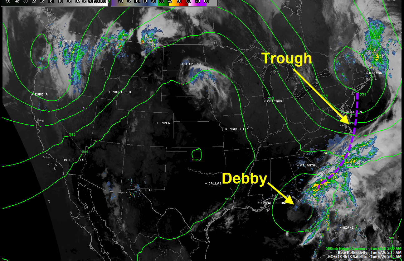
The trough shown in the image above is finally picking up the tropical storm it appears, perhaps saving Florida from 304 more days of rains of Biblical proportions.
The tropical storm is maintaining its strength. Top winds are 45 mph. Here are the particulars from the 4 a.m. advisory.
SUMMARY OF 500 AM EDT…0900 UTC…INFORMATION
———————————————-
LOCATION…29.0N 84.5W
ABOUT 85 MI…135 KM W OF CEDAR KEY FLORIDA
MAXIMUM SUSTAINED WINDS…45 MPH…75 KM/H
PRESENT MOVEMENT…E OR 90 DEGREES AT 3 MPH…6 KM/H
MINIMUM CENTRAL PRESSURE…991 MB…29.26 INCHES
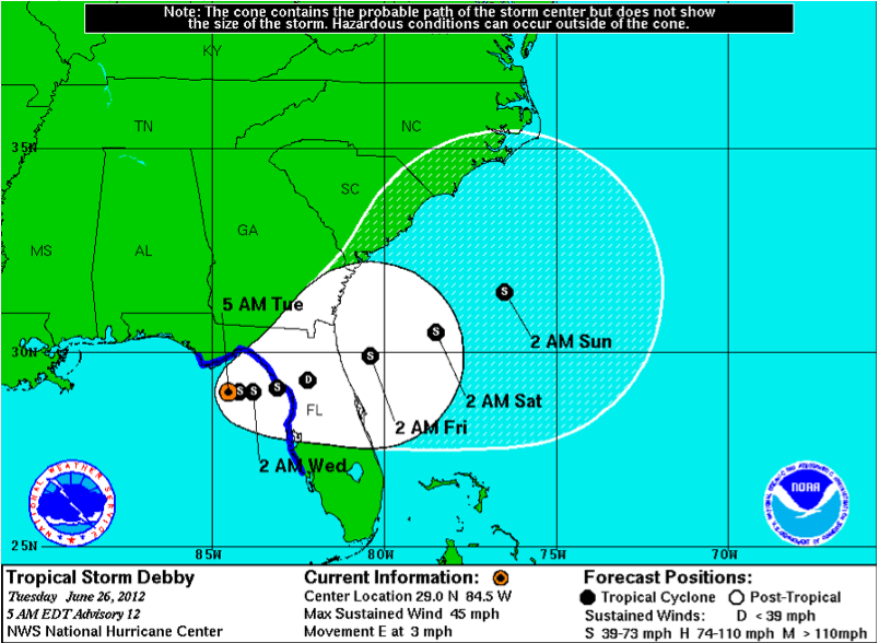
Here is the new forecast track:
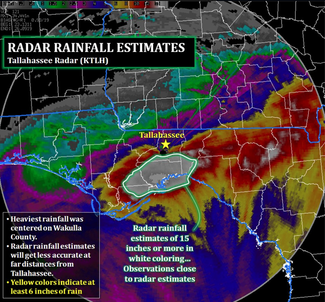
Rains of over 15 inches have fallen over a wide area of the Florida Panhandle, over the area depicted in white from the NWS Tallahassee.