


I have no better idea of where Gustav is going than anyone else. But like most meteorologists concerned with the Southeast US, I have been watching with interest all the developments in the tropics over the last couple of days.
Sure is interesting to see the lineup of three disturbances across the tropics in one satellite image, one in the Southwest Gulf, Gustav, and Hanna. And then there is another disturbance behind Hanna and yet another one coming off the African Coast.
But I was absolutely blown away by the solution of the European model. It has decided that Gustav will come into the Louisiana coast around 12Z on Tuesday morning – image one. This is pretty much in reasonably agreement with the bulk of the various models. And then, it brings Hanna through the Bahamas and the Florida Straits with a glancing blow to the north coast of Cuba before crossing the Gulf, and – you guessed it – plowing into the Louisiana coast around midday on September 6th – image two.
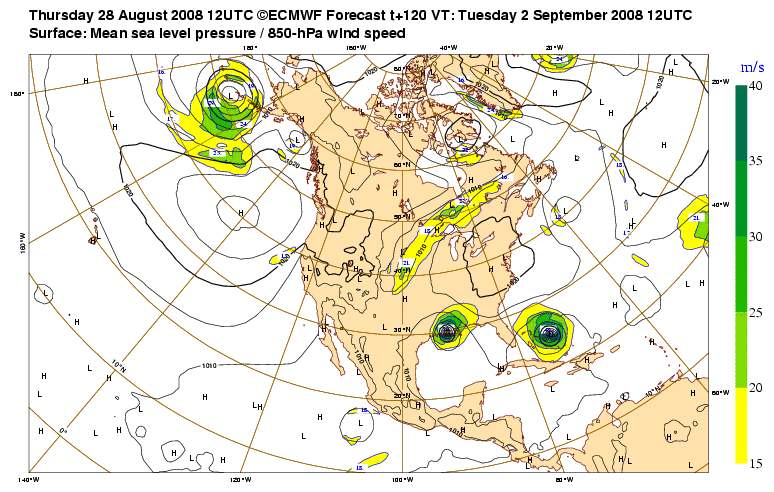
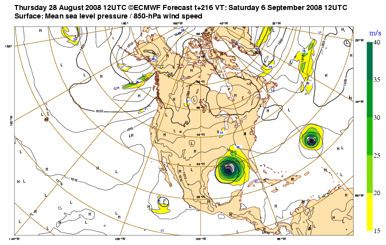
Wow, this is really an unthinkable solution. Should Gustav reach Category 2 or 3 status, the people along the Louisiana coast would hardly have time to pick up the pieces before the next one comes charging at them. I am not saying this is what will happen, but this is definitely a scary scenario to consider. And with some of what we’ve seen this hurricane season, it is just not impossible.
It is a big atmosphere out there, so let’s hope there is enough change to put Hanna on a different track.
-Brian-



