


RADAR CHECK: We have a few patches of light rain over North Alabama this morning, and one or two showers over the southern counties of the state. This activity is ahead of a surface front that will push southward today; by mid to late afternoon any showers will be confined to areas near the Gulf Coast. Most of Alabama will be dry today with a high close to 80 degrees.
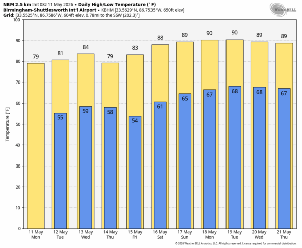
The rest of the week looks generally rain-free. A front Wednesday will pass through in mostly dry fashion; any showers will be few and far between. Temperatures through the week will be close to average for mid-May with highs in the 77-84 degree range on most days.
THE WEEKEND: An upper ridge begins to build, and heat levels begin to rise across the Deep South. Afternoon highs rise into the 87-92 degree range, and any showers will be very isolated. Most Alabama communities will stay dry.
Next week looks more like early summer as the jet stream continues to shift northward; temperatures will be above average with highs in the upper 80s and low 90s. There could be a few days with “scattered, mostly afternoon and evening showers and thunderstorms”, but widespread rain doesn’t look likely. See the video briefing for maps, graphics, and more details.
ON THIS DATE IN 1970: An F5 tornado struck the city of Lubbock, TX killing 26 persons, injuring more than 1500 others, and causing $135 million in damage. It was the most destructive tornado ever up until that time. The twister hit a 30-story building in downtown Lubbock, twisting the structure and blowing out all the windows, but leaving it intact. The building still stands today.
Look for the next video briefing here by 3:00 this afternoon… enjoy the day!



