THIS AFTERNOON: The sky is partly to mostly sunny over the western half of Alabama this afternoon, where temperatures are in the 80s. But, clouds are hanging tough over the eastern counties of the state where they are holding in the 70s. No rain on radar. Tonight will be mostly fair and pleasant with a low in the upper 50s and low 60s.
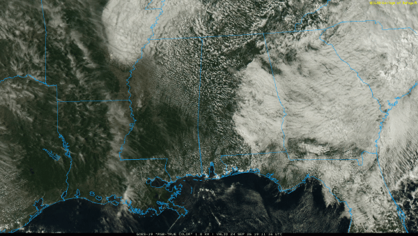
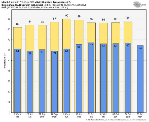
The weather will stay dry tomorrow through the weekend with warm afternoons and pleasant nights. Highs will be in the 80s, morning lows in the upper 50s and low 60s for most places.
NEXT WEEK: Global models have shifted a bit; now suggesting a decent part of next week will be dry. We might have a few isolated showers around, but a strong upper trough will likely hold well to the west of Alabama through the week. Heat levels creep up again, with afternoon highs around 90 degrees by Tuesday and Wednesday. Rain chances will likely increase by the following weekend (October 3/4)…. See the video briefing for maps, graphics, and more details.
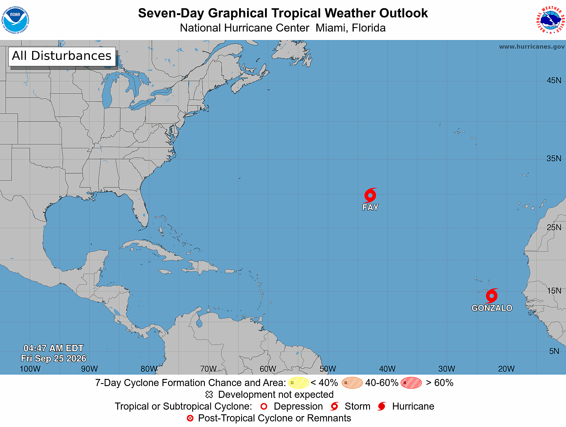
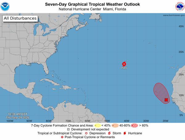
TROPICS: Tropical Storm Fay has come back to life in the middle of the Atlantic with winds of 50 mph. But, it will likely dissipate again in a few days far from land as it encounters strong winds aloft.
Out in the far eastern Atlantic an elongated area of low pressure located a few hundred miles south-southeast of the Cabo Verde Islands is producing a large area of disorganized showers and thunderstorms. This system could become a short-lived tropical depression or tropical storm later today or tomorrow while it moves northwestward to northward. Increasing upper-level winds, however, should prevent further development over the weekend.
No tropical storms or hurricanes are expected near the Gulf or the U.S. for at least the next 7-10 days.
FOOTBALL WEATHER: UAB has a Friday night special this week… the Blazers host Navy tomorrow evening (6:00p CT kickoff at Protective Stadium). The sky will be clear with temperatures falling from near 83 at kickoff into the 70s during the second half.
Auburn hosts Vandy Saturday (3:15p CT kickoff at Jordan-Hare)… the sky will be sunny with temperatures in the low to mid 80s.
Alabama will play South Carolina Saturday night in Tuscaloosa (6:00p CT kickoff at Bryant-Denny)… expect a clear sky with temperatures falling from the low 80s at kickoff into the 70s during the second half.
Jacksonville State, Alabama State, North Alabama, and Samford all have home games; Saturday will be dry statewide with a high in the 80s… temperatures come down into the 70s soon after sunset.
ON THIS DATE IN 2005: Hurricane Rita made landfall between Sabine Pass, Texas and Holly Beach, Louisiana, with winds of 115 mph (category three). Two days before landfall Rita was at category five strength with winds of 180 mph. At the time it was the most intense hurricane on record in the Gulf; Milton would tie Rita for that record in 2024.
In Louisiana, Rita’s storm surge inundated low-lying communities along the entire coast, worsening effects caused by Hurricane Katrina less than a month prior, such as topping the hurriedly-repaired Katrina-damaged levees at New Orleans. Parishes in Southwest Louisiana and counties in Southeast Texas where Rita made landfall suffered from severe to catastrophic flooding and wind damage.
An estimated 2.5 – 3.7 million people fled prior to Rita’s landfall, making it the largest evacuation in United States history. The evacuation was called as a significant heat wave affected the region. The combination of severe gridlock and excessive heat led to between 90 and 118 deaths even before the storm arrived. It was suspected that most of the deaths attributed to heat stress were a combination of hyperthermia and chronic health conditions. In addition to the heat-related deaths, 23 nursing home evacuees were killed after a bus caught fire on Interstate 45 near Wilmer.
Look for the next video briefing here by 6:00 a.m. tomorrow…