


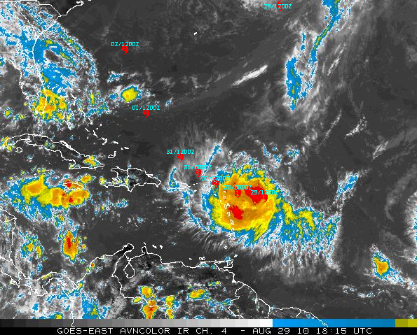
Hurricane Earl is about 240 miles east southeast of the British Virgin Islands early this afternoon. The outer rainbands are approaching the islands of Antigua and Barbuda.
Earl will come very close to Barbuda and the British Virgin Islands tonight as it continues on a west northwesterly course. At its closest approach to Barbuda, the western eyewall may be over the island just after midnight CDT tonight and near the island of Anguilla around 8 a.m. CDT. By then, it will be a category two hurricane with top winds of 105 mph or higher.
Next up will be the northernmost British Virgin Islands, and Earl may be a category three hurricane by then. The center should pass just a little north of there about midafternoon, and the islands may well find themselves in the western eyewall as well.
This is a very dangerous situation and residents in the islands must pay close attention to the progress of this increasingly dangerous storm.
By Tuesday morning, it will be clear of the islands and heading northwest. Top winds by then will probably be over 120 mph, keeping Earl a dangerous category three hurricane.
Then things get interesting for the U.S. East Coast. By Wednesday morning, the center will be about 800 miles southeast of Myrtle Beach, SC, heading northwest. It will likely reach peak intensity of 125 mph as it begins to turn north northwest and north. By Thursday morning, it will be 800 miles east of Savannah and heading north at nearly 20 mph. Top winds should still be over 120mph.
By Friday morning, it will be east of the Chesapeake, moving north and drawing a bead on eastern Massachusetts. It could impact Cape Cod, Nantucket and Hyannis.
Earl will make for some nervous storm watching this week from folks from the Carolinas to New England this week.
DISTURBANCE 97L: The disturbance in the eastern Atlantic lost some of convection this morning but still is fairly well defined. It is barely below tropical depression status, and that could come at any time. The GFS has picked up on the idea of this becoming Fiona and has it following in the footsteps of its older brother Earl, moving just north of the islands Wednesday night and carrying it well east of the Carolinas by next Sunday.
We are fortunate at this point as to how the steering currents have setup and hopefully they will stay that way so this trio of tropical trouble can stay east of the U.S.



