


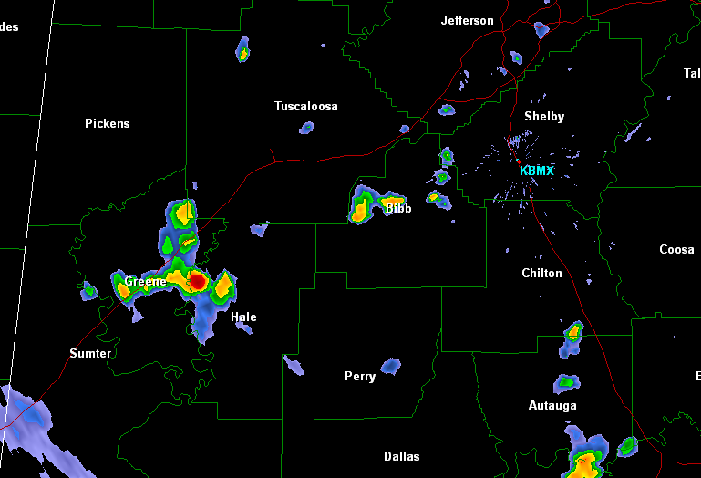
A few showers and thunderstorms continue to pulse up in intensity this evening. Most of the area remains fairly calm.
These storms continue to work their way off to the north and east. Could be affecting Tuscaloosa in about an hour if they hold together. The storms in eastern Bibb County could make into Birmingham in a short while as well.
Expect heavy rain, gusty winds, very dangerous cloud-to-ground lightning and some hail are all possible if you are under one of these storms.
There are no severe storms at this time. Warm air aloft has worked in across our region and has really limited the development of thunderstorms this afternoon.
Expect an active weather week across much of Alabama, as a slow moving front stalls and washes out in the region. This will add additional uplift and convergence and will aid in the development of widespread showers and thunderstorms all week. Some sections of Alabama may pick up 2-3 inches of much needed rain.



