


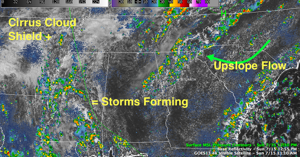
Showers and storms have been more prevalent in Mississippi, closer to the deeper moisture as we thought.
But storms have started to develop over eastern Alabama as well, something we hadn’t anticipated.
As is often the case in summer, subtle things make a big difference in what happens.
Two things are at play. First, those high clouds you noticed this morning have kept temperatures underneath them lower than the surrounding areas. This means areas along the I-59 corridor from Birmingham on northeast have been slower to reach the convective temperature, or point where showers and storms start to form.
Secondly, the light southeasterly surface flow around the surface high centered over southwestern Virginia is rising as it flows into and up and over the foothills of the Appalachians over Northeast Alabama and North Georgia. This upslope flow is combining with the differential heating boundary produced by the blanket of high cirrus clouds to produce the showers and storms!



