


The airmass over the Deep South is juicy today. No worrying about whether there is enough moisture to support storms. Dewpoints are in the upper 60s across Central Alabama.
There are a few breaks in the clouds over West Central Alabama. This will allow temperatures to warm quickly into the 70s. The BMX sounding at 7 a.m. already indicates 653 j/kg of CAPE here. That number will rise to above 1000 j/kg with the morning heating. It will go to above 1,5000 j/kg with a little extra sun.
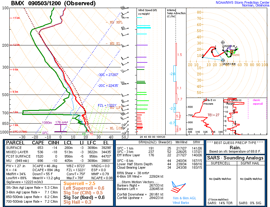
There is a good deal of dry air up at about 9-10K feet. That will enhance the threat for damaging winds.
We may deal with three systems today.
1. The Quasi-linear convective system coming out of Mississippi right now. This thunderstorm complex can produce swaths of damaging winds, especially along bulges in the line. Significant tornado can also spin up at the apex of these bulges. This line will move northeastward along a gradient of instability left from last night’s storms that extends to north of Tuscaloosa and Birmingham.
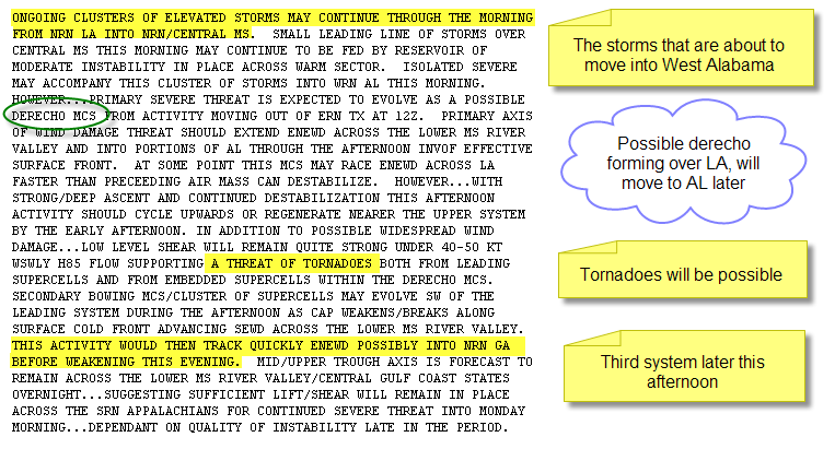
2. A big storm complex over astern Texas that is expected to develop into a derecho. A derecho is a widespread damaging wind event that extends over hundreds of miles with sustained winds of at least 58 mph. This system is expected to sweep across Louisiana and Mississippi and could reach West Central Alabama this afternoon.
3. Additional severe storms will develop near the cold front. These storms will sweep into Alabama this evening.
The SPC feels so strongly about the potential for this threat that they have upgraded the convective outlook to a Moderate Risk into West Central Alabama.
Their probalistic damaging wind threat graphic:
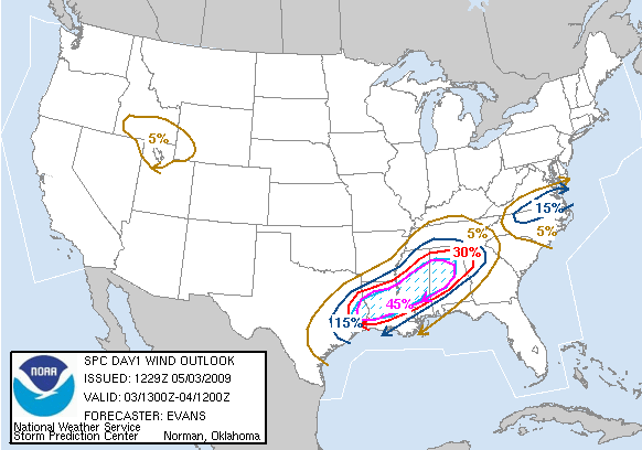
This says there is a 45% chance that there will be one or more damaging wind events within 25 miles of the points in the hatched area. This area goes as far north of Hamilton and Oneonta and includes Tuscaloosa and Birmingham.
Here are some notes from the convective outlook:
PLENTY OF ADVANCE NOTICE
Thunderstorm winds can cause havoc like a significant tornado and they can kill. Go ahead now and plan your day with the weather in mind. Be ready to leave mobile homes for substantial structures well in advance of the storms’ arrival. Know where you will go today, whether you are at church, at the lake, at home, or at work. Check your plan and be ready.



