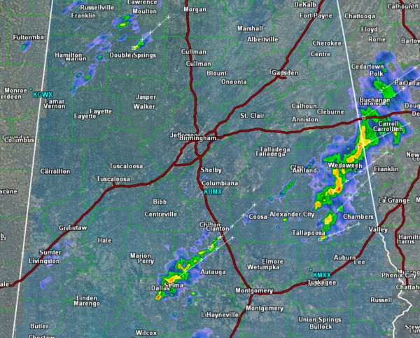
A few showers and thunderstorms have developed across Alabama this evening. Currently we are seeing some of the more intense activity across eastern portions of the state affecting areas in Chambers, Randolph, and Tallapoosa Counties. More showers are ongoing across Chilton, Autauga, and Dallas Counties, and we have seen a few isolated cells across portions of Marion and Winston Counties.
The SPC maintains a slight risk for severe weather across much of Alabama for the overnight hours. There is a very warm, moist air mass in place across the state. A strong cold front is moving in from the west, but the dynamics needed for severe weather are off to our northwest.
Tonight’s activity will continue to move towards the northeast. Looking west into Mississippi, not much showing up on the radar. We do expect additional showers and storms overnight, and some of these storms could be strong, but the severe weather threat is very limited. The main concern over the next few days could come in the form of a flooding threat. The computer models are suggesting that many areas across north-central Alabama could see 2-3 inches of rain, with some areas possibly receiving up top 5 inches.