


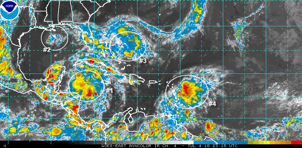
Thunderstorms associated with the tropical wave over the western Caribbean (#1) flared up Sunday afternoon, and it looks like we could be watching our next named storm getting ready to form. The Canadian model develops a storm over the southern Gulf and moves it quickly toward Louisiana by Wednesday night. The HWRF is déjà vu with a system that acts just like Hurricane Alex from last week. The GFS refuses to develop anything just yet.
Neither the low over the northern Gulf (#2) or the disturbed weather east of Florida (#3) show much promise tropically speaking.
The tropical wave entering the eastern Caribbean (#4) shows some promise and will have to be monitored this week.



