


Nobody knows just yet how this pre-Christmas storm will line up, but it will be significant, and produce both the potential for significant snow and strong thunderstorms for the eastern half of the nation. I have no real interest in individual computer model runs at this time, but I think the 06Z GFS has a plausible idea…
This is the look at 12:00 noon Christmas eve:
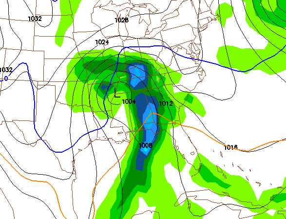
A surface low near Memphis (note the GFS has that low near Chicago at one point yesterday!); that suggests a good rain/storm event for Alabama Wednesday night into Thursday morning.
Now, see the look at 12:00 midnight Christmas eve:
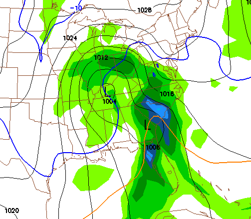
See how the energy transfers to a new developing low on the Georgia coast, with colder air flooding into Alabama and some chance of a change to snow on the backside. No, this won’t bring a big snow here, but maybe enough to get the ground white. And, no, most likely the storm won’t pan out this way. But, I think the idea is a good one.
Again, we really won’t have a good handle on this until early in the week, but the players are clearly on the field… might not snow a single flake here, or it might be a Christmas we can remember. Nobody knows yet… including us in the weather office, the trolls, haters, and know-it-alls. But we will all be watching…



