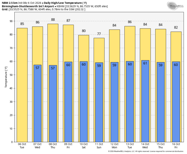
THIS MORNING: We have some lingering light rain across the southeast tip of Alabama around Dothan, but it feels like fall across the Tennessee Valley where the sky is clear and temperatures are well down in the 50s. The rain will end soon across the southeast counties; expect a mostly sunny sky today with a high in the 80s.
The weather for most of the state will stay dry through Friday with highs mostly in the 80s… a few spots across West Alabama could touch 90 degrees Thursday and Friday.
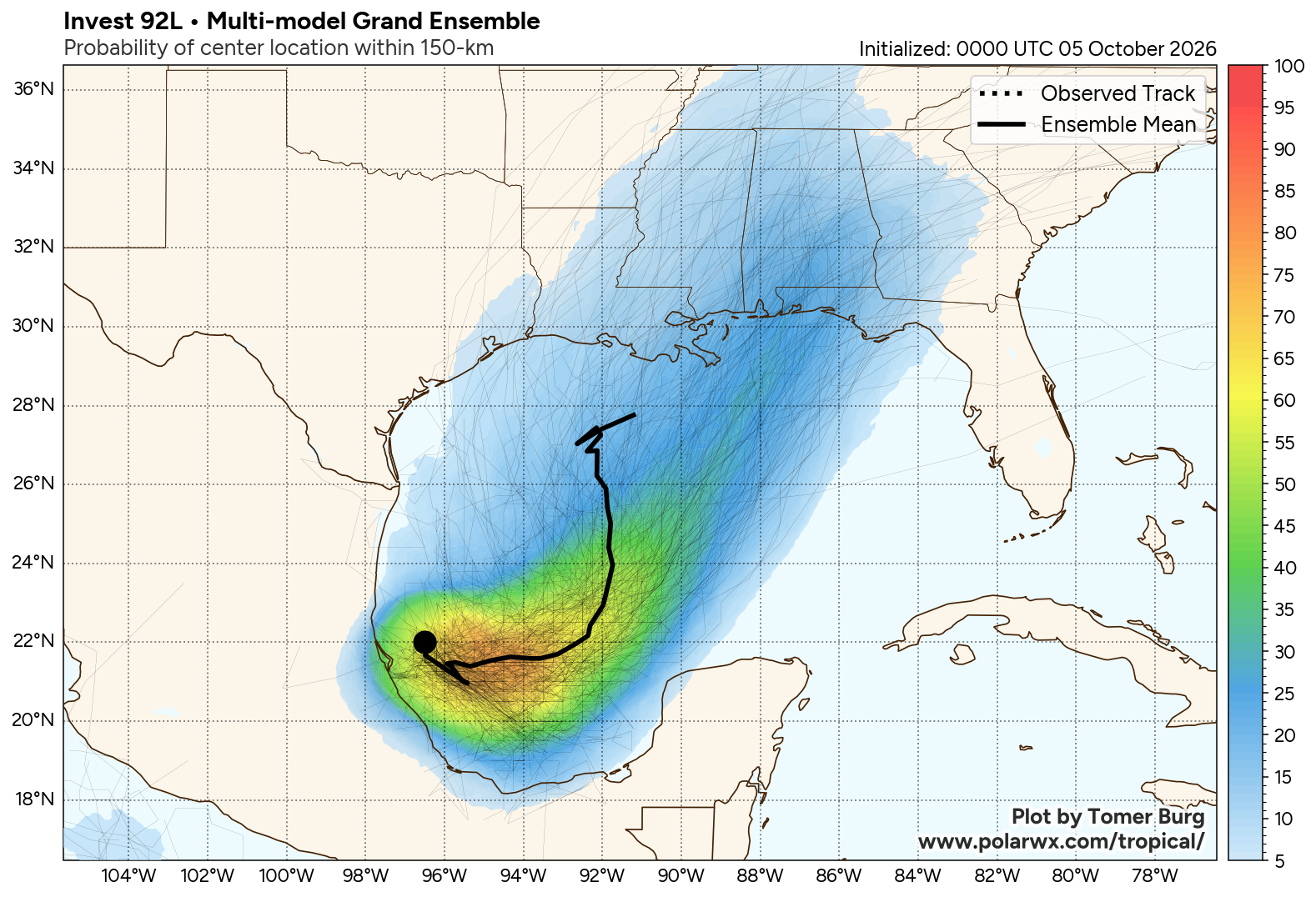
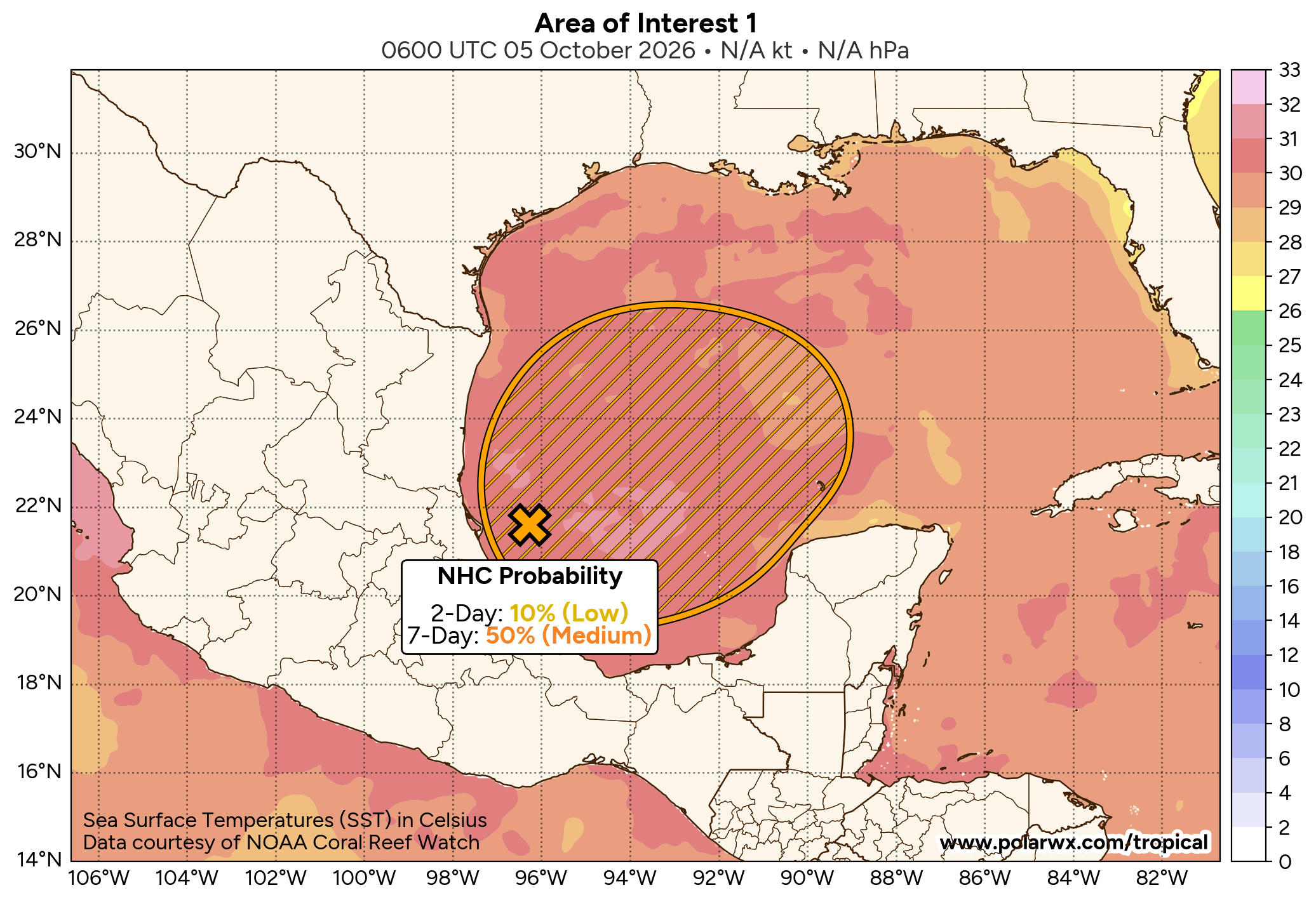
TROPICS/THE WEEKEND: A trough of low pressure (Invest 92L) over the southwestern Gulf is producing disorganized showers and thunderstorms. Although environmental conditions appear only marginally conducive for development, a tropical depression is likely to form within the next couple of days. The system is expected to drift east-northeastward through the middle portion of the week before turning northward.
Most reliable models and their ensemble members bring the system to the Central Gulf Coast around Mobile Bay Saturday. Concerning intensity, this could be a strong tropical storm or even a hurricane at the time of landfall. The name will be Isaias.
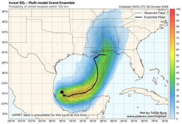
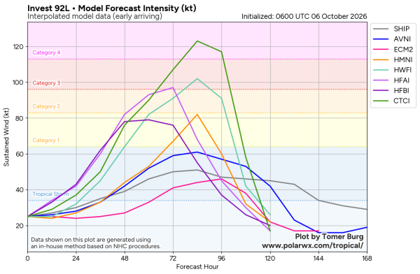
Isaias has potential to be a high impact event for the Gulf Coast and the state of Alabama, but it is important to note that it is still too early for a specific impact forecast for any place. There are many big events going on, including the National Shrimp Festival in Gulf Shores, the Alabama/Georgia football game in Tuscaloosa, and the Zach Bryan concert in Auburn.
Saturday isn’t looking good this morning based on the latest model output; it will be a day with lots of rain, and potentially lots of wind. Maybe even some risk of a few isolated brief tornadoes. But understand this could change based on the ultimate track and intensity of the tropical system.
We will be much more specific tomorrow evening; this is when the system will have developed a core, and we get dropsonde data from hurricane hunter aircraft, which will be baked into the models. For event planners I would not make a decision until tomorrow night.
Rain should begin to taper off across the state Sunday as the tropical system begins to move away.
NEXT WEEK: The weather looks generally dry with warm afternoons; highs will be in the 80s. See the video briefing for maps, graphics, and more details.
ON THIS DATE IN 2016: The center of Category 4 Hurricane Matthew passed within 100 miles of Miami. The storm then paralleled the coast of the southeastern United States over the next 36 hours, gradually weakening while remaining just offshore before making its fourth and final landfall over the Cape Romain National Wildlife Refuge near McClellanville, South Carolina as a Category 1 hurricane on the morning of October 8.
Look for the next video briefing here by 3:00 this afternoon… enjoy the day!