


I mentioned this the other day on the big WeatherBrains netcast, but wanted to bring it up here…
One of my favorite things to do is track a dry cold front and run outside to feel the wind shift around from south to north and the cooler air spill in behind the front. If you time it right it usually takes only minute or two.
You can find these dry fronts on your favorite local radar. The NWS folks usually run the radar in clear air mode, which is more sensitive, and the front will show up as a band on the display. I lifted this image from a great website called WeatherTap.com while waiting for the lastest front to come through Dallas. Is shows as that yellow band on the northwest side of the ground clutter pattern…
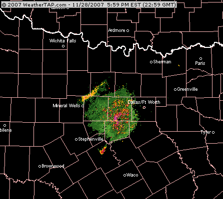
If you loop the radar you can time the front into your area, remember that the radar images might be a few minutes old.
Weather Geek? Yes…join me, it is “cool”.



