


We continue to refine our forecasts in preparation for a significant winter storm that will affect parts of Alabama beginning today.
The 6 p.m. run of the NAM depicts a much stronger wave of surface lo pressure developing along the Texas coast late tomorrow night and moving into South Alabama by Wednesday morning. This would result in much warmer air and more moisture moving northward into Alabama. This is really good news, but it is just one run of one model.
Here is the accumulated precipitation by type from the NAM through early Wednesday morning:
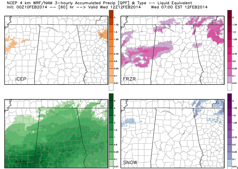
There would still be significant icing early Tuesday over West Central and North Central Alabama from parts of southern Lamar and Pickens into Fayette, northern Tuscaloosa, Walker and western Jefferson County, but the situation would be marginal in the Birmingham area with temperatures near freezing. But temperatures would rise back above freezing Tuesday morning across the area.
There would be much less snow with this scenario. In fact, there would be limited snow accumulation early Tuesday morning in areas around Walker, Lamar and Pickens Counties.
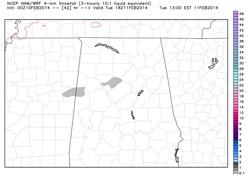
One interesting development is an upper level low that swings across, cooling upper level temps and turning precipitation to snow on the back side of the system across much of North and Central Alabama Wednesday afternoon. There could be 1-2 inches of snow.
You can see the level of uncertainty still involved in this forecast. We will be eagerly waiting the output from the GFS and European models this evening.
We will have an updated forecast as soon as we see the data.



