


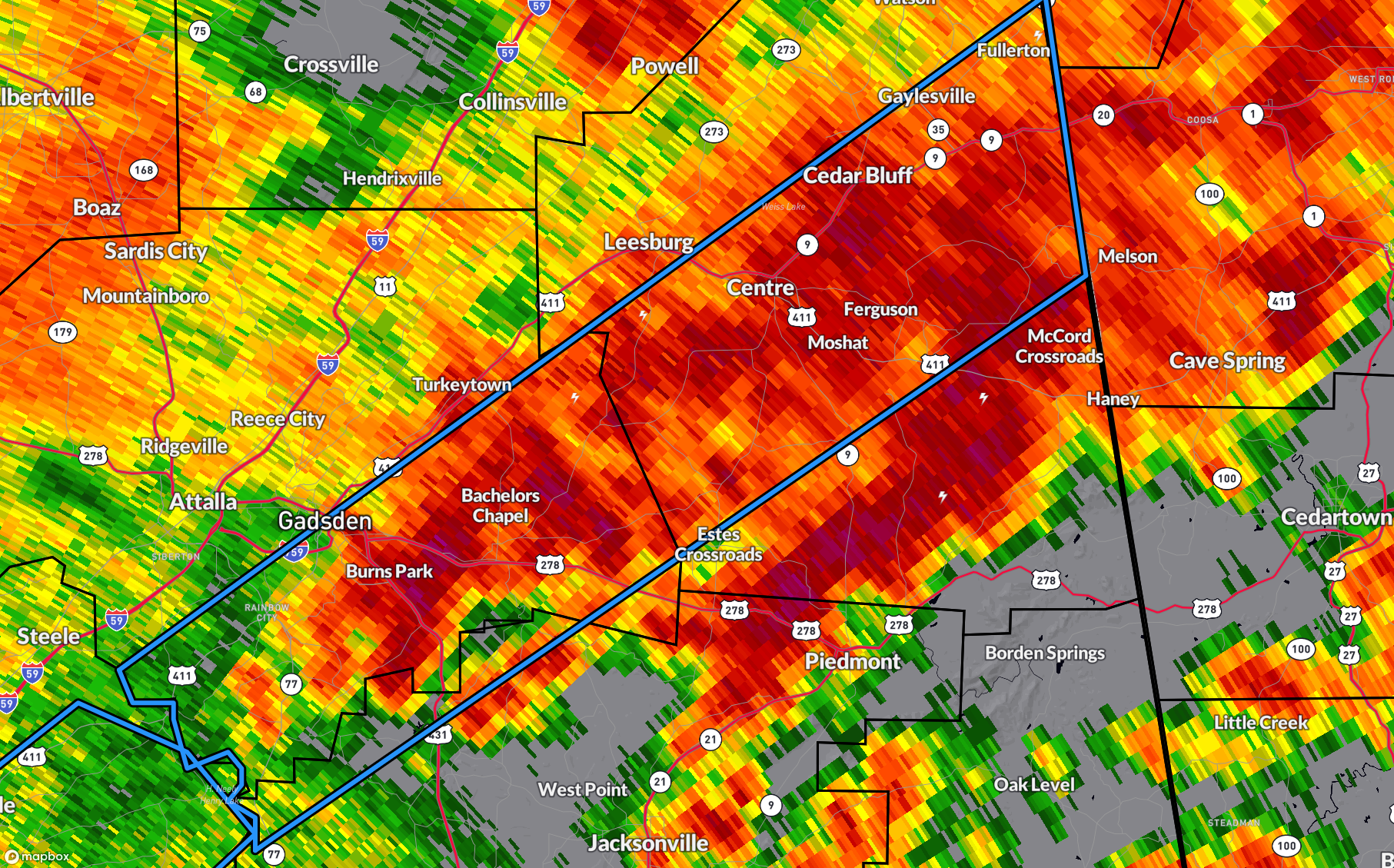
The National Weather Service in Birmingham has issued a
* Flash Flood Warning for…
Northwestern Calhoun County in east central Alabama…
Southern Cherokee County in northeastern Alabama…
Southeastern Etowah County in northeastern Alabama…
* Until 400 AM CST.
* At 114 AM CST, Doppler radar indicated thunderstorms producing
heavy rain across the warned area. Flash flooding is ongoing or
expected to begin shortly.
HAZARD…Flash flooding caused by thunderstorms.
SOURCE…Radar.
IMPACT…Flash flooding of small creeks and streams, urban
areas, highways, streets and underpasses as well as
other poor drainage and low-lying areas.
* Some locations that will experience flash flooding include…
Gadsden, Rainbow City, Hokes Bluff, Centre, Cedar Bluff, Centre
Municipal Airport, Glencoe, Ohatchee, Gaylesville, Ballplay, Ball
Flat, Tennala, Western Weiss Lake, Moshat, Eastern Weiss Lake,
Gadsden Mall, Cornwall Furnace Park, Neely Henry Lake, Southside
and Reaves.
PRECAUTIONARY/PREPAREDNESS ACTIONS…
Turn around, don’t drown when encountering flooded roads. Most flood
deaths occur in vehicles.
Be especially cautious at night when it is harder to recognize the
dangers of flooding.
Be aware of your surroundings and do not drive on flooded roads.



