


The flash flood warning for Shelby County expired at 1:30 p.m. But flooding continues across parts of Shelby County so the NWS issued a new Areal Flood Warning for western Shelby County.
* FLOOD WARNING FOR WEST CENTRAL SHELBY COUNTY IN ALABAMA…
* UNTIL 430 PM CDT
* AT 125 PM CDT…LOCAL LAW ENFORCEMENT OFFICIALS REPORTED FLOODING
IS CONTINUING ACROSS THE AREA FROM PREVIOUS HEAVY RAINFALL.
FLOODING CONTINUES ALONG SOME STREETS AND ROADWAYS IN THE ALABASTER
AREA…ESPECIALLY IN AREAS ALONG AND NEAR THOMPSON ROAD AND HIGHWAY
119. FLOODWATERS ALSO CONTINUE TO MOVE DOWN BUCKS CREEK.
ALTHOUGH RAINFALL HAS TAPERED OFF IN THE AREA…FLOODING WILL
CONTINUE FOR THE NEXT FEW HOURS AS FLOOD WATERS SLOWLY RECEDE.
* SOME LOCATIONS THAT WILL EXPERIENCE FLOODING INCLUDE…ALABASTER…
HELENA…AND MAYLENE.
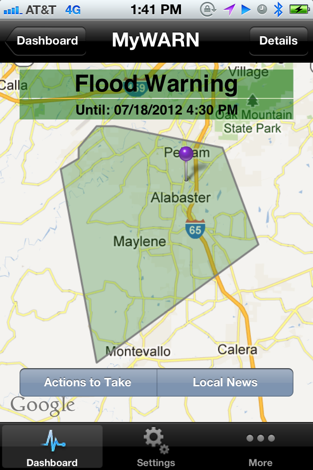
Areal flood warnings don’t show up in many automated systems. For example, they are not displayed on Gibson Ridge radar screens. But they are important. They are automatically transmitted on the MyWARN severe weather notification system. MyWARN has been cranking out literally thousands of watch, warning and severe weather risk alerts today. All in less than 10 seconds from the time they left the NWS forecasters’ keyboards.
The beauty of this app is that is only notifies you if you are IN the warning polygon. For example, people at Oak Mountain State Park would not have received this alert on MyWARN since they aren’t included. But if they drove to downtown Pelham, the alert would have been sounded when they entered the polygon.
Learn more about this revolutionary, game changing app on the MyWARN website.



