


LATE REPORT AT 12:58:
Spotter report of a large wall cloud with rotation in Mt. Hope. The rotation is passing of Hatton and will pass near or north of Moulton. Be in safe shelter now.
Watching storm over eastern Franklin County with great interest even though it is not in our viewing area. It is showing increasing signs of producing a tornado. There is now a Tornado Vortex Signature on the Columbus radar and the ARMOR radar at Huntsville actually showed a “donut hole” on their display.
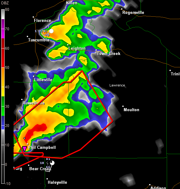
This storm will track near Moulton and eventually near Decatur and Athens. It is in an area that has geographically been favorable for tornado development.
Alan in Bear creek reported a wind gust to 47 mph as the storm passed to his north. He passed along a report from the Bear Creek VFD that a funnel was trying to form between Bear Creek and Phil Campbell. This storm is passing into Lawrence County and a new tornado warning is forthcoming from the NWS HUN.



