


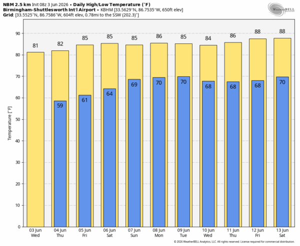
DRIER AIR ARRIVES: While a few isolated showers could form this afternoon over Mobile and Baldwin counties, the rest of Alabama will be rain-free today with a sunny sky and lower humidity. Tonight will be clear and cool; most of Alabama will enjoy a low in the 55-60 degree range early tomorrow morning.
Dry weather continues tomorrow and Friday with lots of sun and low humidity levels for June.
THE ALABAMA WEEKEND: Moisture levels will rise. At this point it looks like the best chance of scattered showers and thunderstorms on Saturday will be over the southern third of the state. Then, we will mention a chance of scattered showers and storms Sunday statewide. The weekend won’t be a wash-out, and the showers will be most numerous between noon and midnight. Afternoon highs will be in the 80s.
NEXT WEEK: At this point it looks like we will experience routine June weather through the week. Warm, humid days, highs in the 80s, and the daily round of “scattered, mostly afternoon and evening showers and thunderstorms. See the video briefing for maps, graphics, and more details.
TROPICS: The Atlantic basin remains quiet and tropical storm formation is not expected for at least the next seven days.
ON THIS DATE IN 1989: Thunderstorms developing over the Southern Plains Region during the afternoon hours produced severe weather into the night. Thunderstorms spawned eleven tornadoes, and there were 169 reports of large hail and damaging winds. Thunderstorm winds gusted to 80 mph at Newcastle, OK, and Wilson, OK.
Look for the next video briefing here by 3:00 this afternoon… enjoy the day!



