


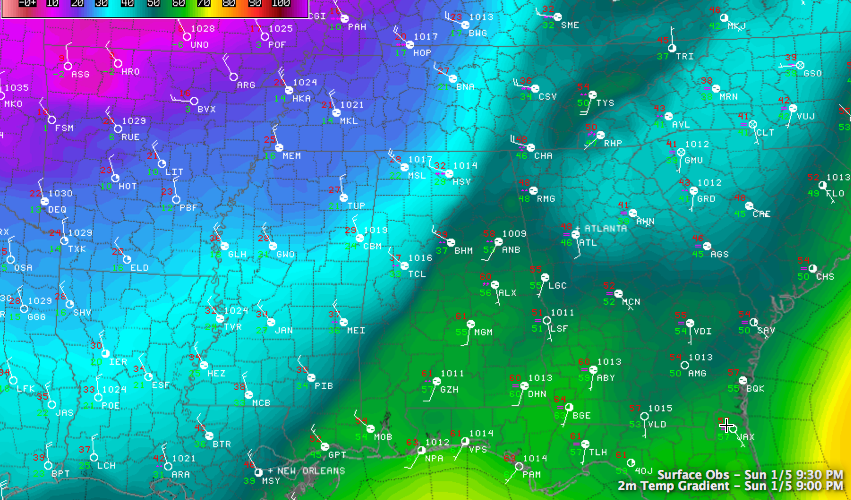
The Winter Weather Advisory has been cancelled since the precipitation is ending before temperatures get to critical levels and roads seem to be drying nicely.
Having said that, there will still be places with standing water on roadways overnight that will freeze into dangerous black ice, which is hard to prepare for if you are driving. Bridges and overpasses will be especially susceptible. You don’t see the invisible ice at night until you are on it, and then it is too late.
And tunnels. Bryan Falls reports Homewood PD says that tunnel at Palisades Drive is icing. An example of what we will deal with overnight.
A late report at 10:08 says that police in Cullman are reporting the Walnut Street NE bridge is being closed due to icing.
If you are driving later tonight or early Monday morning, take it easy, give yourself extra time and watch out for the other drivers who may not be as careful. Check road conditions between you and your destination before leaving.
Temperatures are below freezing now west of a line from east of Huntsville to Warrior to Tuscaloosa.
Lows tonight will drop into the middle and upper teens, with a strong northwesterly wind making it feel like single digits overnight. The wind advisory and wind chill advisories will remain in effect overnight and on Monday. The wind chill advisory will continue until noon Tuesday.
There will be occasional rounds of sleet and eventually light snow overnight, but additional accumulations aren’t expected. John Talbot reports snow flurries flying around Oak Grove. The only accumulations so far have been in Northwest Alabama around Haleyville and in North Alabama around Hunstville.
MISERABLE MONDAY: We will call for a high of around 20F in Birmingham on Monday. Things will be a little colder across the northern tier of counties, remaining in the teens in places like Hamilton, Cullman and Fort Payne. Winds will remain strong all day, averaging 15-20 mph with gusts to 35 mph at times. This will push wind chills well into the single digits, and occasionally below zero. There wil be a few snow showers from time to time but no accumulations are expected.
BITTERLY COLD MONDAY NIGHT: Single digits will be common across the area Monday night. Winds will remain up a bit overnight, averaging 10 mph through the overnight hours. This will keep it a little warmer than it might have been otherwise, but will drop wind chills into the -10F to 0F range.



