


Daily Weather Briefing
Sunday, August 16, 2026
ALABAMA THIS MORNING
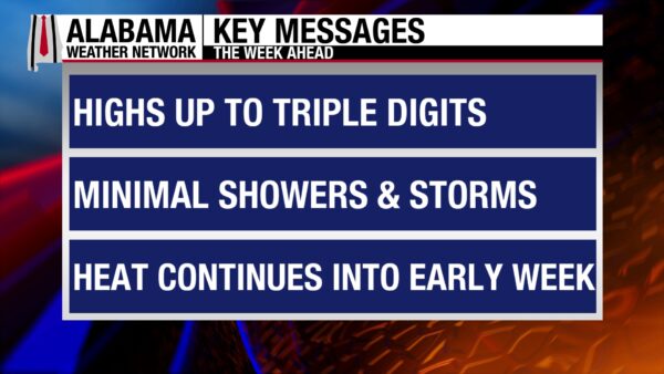
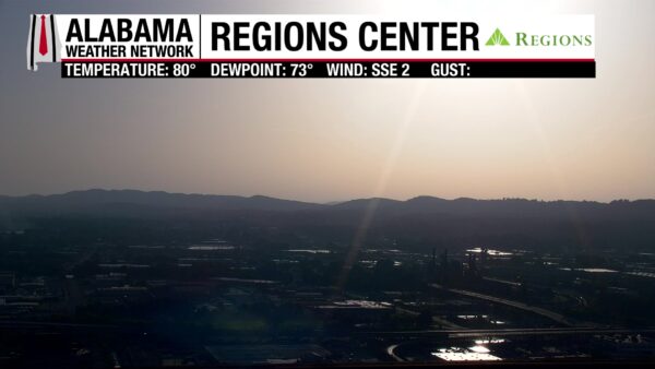
Alabama is dry and warm this morning, with temperatures in the low to mid 70s and dew points in the low 70s. Besides some clouds over southwest Alabama, skies are clear. Our Regions Center Skycam in Birmingham features the bright sunrise over the city this morning.
ALABAMA 7 DAY FORECAST
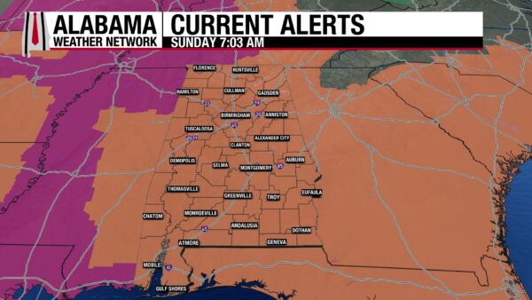
The heat will continue through midweek as the upper-level ridge sits over the South-Central and Southeast United States. It will move slowly westward through Wednesday, allowing an upper-level trough to dig into the eastern U.S. for the second half of the week. This will cool Alabama slightly and bring us some higher rain chances. For now, though, a Heat Advisory is in effect statewide.
HOT AND DRY PATTERN CONTINUES TODAY – Aug 16
Today will be another hot and dry day, with afternoon thunderstorms that will be very isolated. The northern half of the state looks to stay almost completely dry, while the southern half of the state will see a few isolated thunderstorms. Highs will reach the upper 90s statewide, with central Alabama capable of seeing some 100-degree highs. Feels-like temperatures will sit in that same 105-112-degree range we’ve seen all week.
HEAT PERSISTS, THUNDERSTORMS NORTH IN THE AFTERNOON – Aug 17
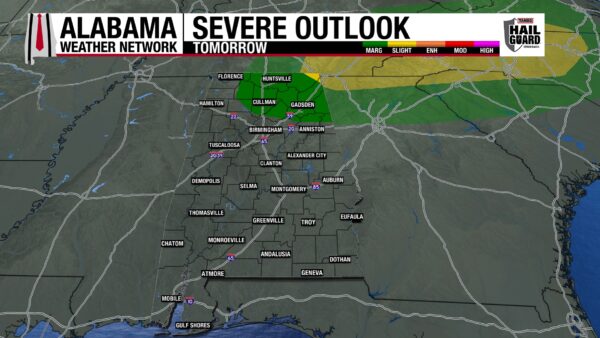
Little will change in terms of the heat on Monday. Highs will reach the upper 90s and around 100 degrees statewide, and feels-like temperatures will rise to the 105-112-degree range. Afternoon showers and thunderstorms will be isolated statewide, with the eastern two-thirds of north Alabama under a Marginal or Slight Risk (1 and 2/5) of Severe Thunderstorms. The Slight Risk just barely clips north Jackson and DeKalb Counties, while the Marginal Risk extends from the Georgia state line to Lawrence County and from the Tennessee state line into most north St. Clair and Calhoun Counties. Essentially, there is a low chance for severe thunderstorms to develop that will produce damaging winds, frequent lightning, and heavy downpours in the areas outlined above.
STILL HOT TUESDAY AND WEDNESDAY – Aug 18-19
Tuesday and Wednesday will still be hot with mostly isolated afternoon thunderstorms.
On Tuesday, highs will hit the mid 90s in the north and east, and the upper 90s to around 100 degrees in the west and south. The slightly lower highs toward the north and east are due to the upper-level ridge moving west. Feels-like temperatures will still, however, sit in that 105-112-degree range. Isolated afternoon thunderstorms are expected statewide.
Wednesday’s highs will hit the mid to upper 90s across the state, and rain chances will stay isolated.
LESSER HEAT TOWARD END OF WEEK – Aug 20-22
Thursday through Saturday will see the heat lessen its grip on Alabama somewhat as the ridge continues to move west.
Highs on Thursday will sit in the mid to upper 90s over Alabama, and rain chances will still be isolated.
Friday sees a higher rain chance statewide, around 40%. This is in response to a cold front that looks to push into Alabama on Friday. The low to mid 90s are anticipated in the northern half of the state while the mid 90s are expected in the southern half.
Rain chances dwindle slightly to 30% across the state on Saturday, and highs again will range from the low to mid 90s in the northern half of Alabama to the mid 90s in the southern half.
RAINFALL OUTLOOK
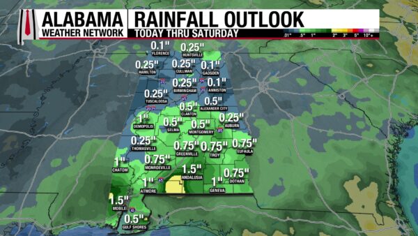
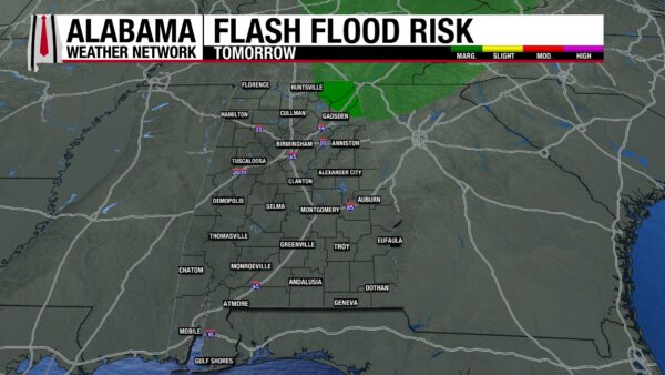
Rainfall amounts expected over this week have increased somewhat in response to Friday and Saturday’s higher rain chances. The northern half of the state can expect to receive a tenth of an inch of rain to a quarter of an inch of rain. The southern half of the state can expect a half-inch to an inch, or even an inch and a half, of rain. A pocket of around 2” looks possible over west Escambia County into southern Conecuh County. Tomorrow, a Marginal Risk (1/4) of Flash Flooding is outlooked for Jackson, DeKalb, and north Marshall and Cherokee Counties as storms that develop in the region could produce downpours that cause flooding in low-lying and poorly drained areas.
THE ATLANTIC QUIETS WHILE PACIFIC STAYS ACTIVE
After a week of watching a few disturbances in the Atlantic for tropical development, upper-level winds and dry air have wiped out the chance for any tropical system development in the basin for the next 7 days.
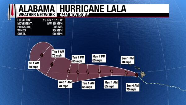
Meanwhile in the Pacific, Category 1 Hurricane Lala has passed the Big Island of Hawaii and sits south of the northern islands with sustained winds of 75 mph and a central pressure of 988 mb. It will weaken to tropical storm strength today and will move west until it restrengthens to a Category 1 Thursday, well west of Hawaii.
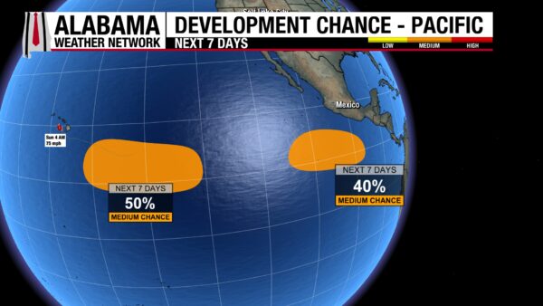
There are also two disturbances the National Hurricane Center has its eye on for potential tropical development this week. The more westward disturbance has a 50% chance of development as it moves westward. The more eastern disturbance has a 40% chance of development this week.
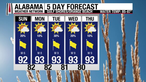
MORE PLEASANT BEACH DAYS AHEAD
Beachgoers are in for a great beach week this week! The high will be in the low 90s each day, rain chances will range from 10-30%, so no washouts are expected, skies will be mostly sunny to sunny, and the UV Index will be Very High to Extreme. Winds will also be from the west around 5 to 10 mph each day. Water conditions will be pleasant as well, with a low rip current risk and a surf height of 1 foot expected through Thursday.
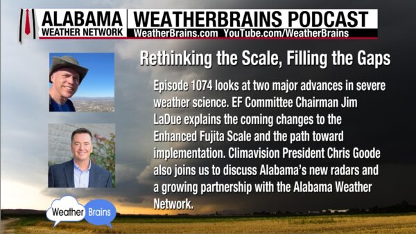
WEATHERBRAINS 1074
Tomorrow’s episode will be all about major advances in severe weather science. EF Committee Chairman Jim LaDue will explain the changes to the Enhanced Fujita Scale, while Climavision President Chris Goode will discuss Alabama’s new radars and their partnership with the Alabama Weather Network. Listen to the episode wherever you get your podcasts or watch here.
TODAY IN WEATHER HISTORY
August 16, 1969 – The Camille Flight
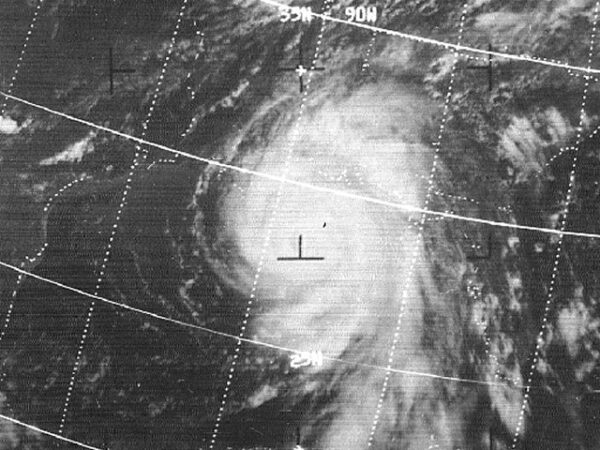
Residents along the Gulf Coast watched Hurricane Camille with growing concern on August 16, 1969. The storm had crossed western Cuba and was rapidly strengthening over the warm Gulf of Mexico. National Hurricane Center Director Robert Simpson was especially uneasy because most Navy and research reconnaissance aircraft had been sent to Puerto Rico for Project Stormfury. Two remaining Navy aircraft experienced mechanical problems and were restricted from penetrating a hurricane of Camille’s strength.
Satellites offered forecasters a view from above, but the technology was still new and limited. Infrared imagery from Nimbus 3 showed Camille’s cloud shield contracting during the night, but specialists disagreed about what that meant. Simpson and the National Hurricane Center believed the change signaled rapid strengthening, while satellite analysts in Washington thought the storm might be weakening. Without direct observations from inside Camille, forecasters could not be certain.
With the typical reconnaissance aircraft occupied or unavailable, Simpson asked the Air Force to send a plane from Illinois into the hurricane. At 6:35 p.m. CDT, the crew measured a central pressure of 908 mb using two separate dropsondes. At 7:16 p.m., another instrument found 905 mb inside an eye only about 10 nautical miles wide. At the time, it was the lowest hurricane pressure ever measured by a reconnaissance aircraft. Later analysis placed Camille’s maximum sustained winds near 175 mph.
The measurements gave forecasters the confirmation they desperately needed. Simpson later said it was time to “ring the bell hard,” and warnings emphasized that Camille could destroy unprecedented proportions. An experimental storm surge model projected water levels near 20 feet, and evacuations were ordered along vulnerable portions of the coastline from Florida to Louisiana.
Camille reached the Mississippi coast near Waveland around 11 p.m. on August 17 with sustained winds estimated at 175 mph and a central pressure near 900 mb. A storm tide reaching 24.6 feet at Pass Christian swept across coastal communities, while the hurricane’s strongest winds destroyed every recording instrument in the immediate landfall area. Camille became the second-most intense hurricane known to strike the continental United States.
The difficulty obtaining direct observations from Camille exposed serious weaknesses in the nation’s hurricane reconnaissance program. After the storm, Congress approved funding to replace aging aircraft, improve onboard weather instruments, and strengthen the dedicated fleet used to fly into tropical cyclones. The unconventional flight into Camille allowed the National Hurricane Center to sound the alarm about its danger and encouraged the modernization of hurricane reconnaissance.
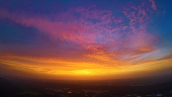
IMAGE OF THE DAY
Skywatcher Joey Amberson captured the colorful sunset in Oxmoor Valley last night! Always appreciate our Skywatchers!



