


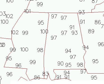
Temperature
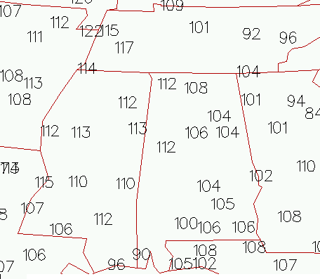
Heat Index
The heat wave continues, with temperatures running about 1 degree warmer than yesterday at this time. Most locations will see highs of 98 to 102 this afternoon, with dangerous heat index of 105 to 115. Eaker AFB in Arkansas has a heat index of 122, as moisture from a rainy year evaporates out of the ground into the extremely hot air. Dewpoints along the MS river near 80
The atmosphere has dried out over its depth, with this morning precipitable water below 2″ at BHM. So, thunderstorms will be isolated. Where they form in this unstable environment, they may produce heavy rainfall, lightning, and strong winds. But, most people won’t get any rain.
The long range models are hinting at a weak front this weekend, at least bringing an increase in moisture and more clouds and thunderstorms. That should moderate temperatures a little by then, maybe down to the lower and mid 90s, but with high humidity it will still be very hot, with heat index near 100.
Be careful not to get too used to the heat and forget about normal precautions (frequent breaks of outside, lots of water, outdoor activities before 11 am or after 7 pm if possible). I’ve noticed that 95 doesn’t even feel that hot to me right now…my body has adjusted. But, it’s still as dangerous.



