


Severe thunderstorm and flash flood warnings for parts of the New York City metro area this afternoon.
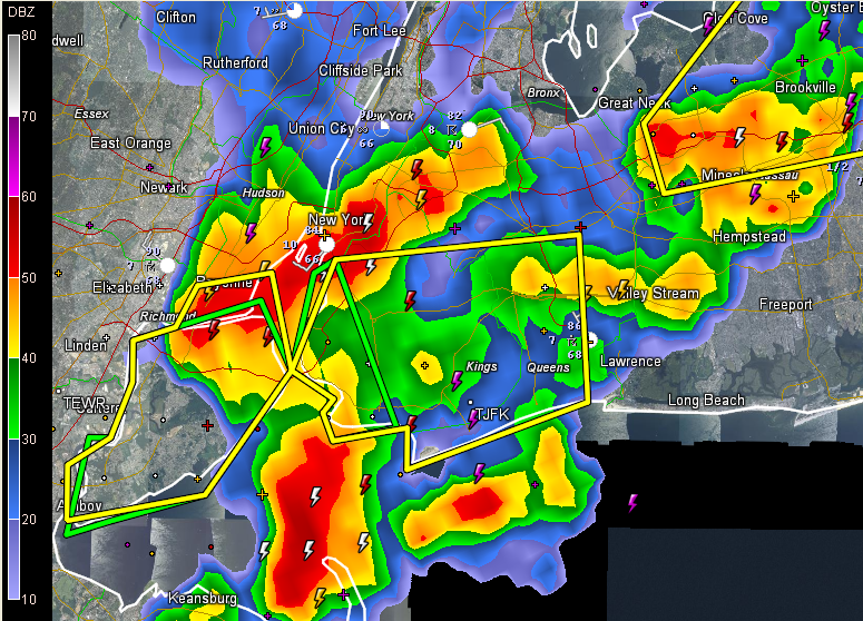
A severe thunderstorm warning is in effect for Queens, Brooklyn and Staten Island.
Heavy rain is falling over Manhattan and Midtown now.
Severe weather is a good bet this afternoon from New York City down the Northeast Corridor to Baltimore and Washington, D.C.
IN THE TROPICS
Chris is now extratropical. This doesn’t make it any less of a storm for shipping concerns, but just means it is no longer has the requisite warm core of a tropical cyclone.
The surface low in the Gulf is actually better defined although the thunderstorm activity is still disorganized. Here is a recent satellite picture with the isobars and station plots overlain.
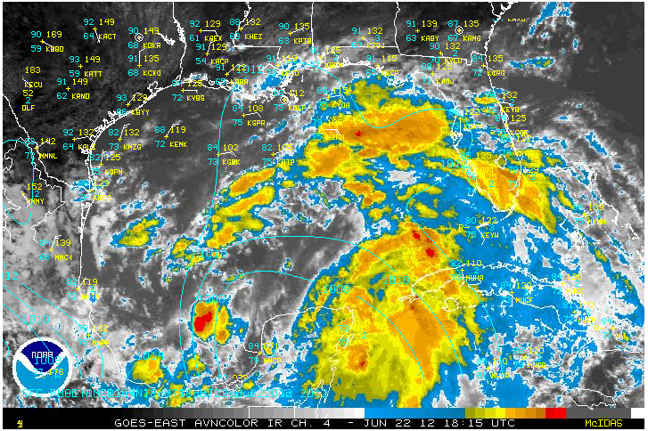
The recon mission scheduled for today was scrubbed, but I do see a non tasked Air Force mission flying over the Central Gulf now. There was just a dropsonde released over the eastern Gulf. I will try to find out if that is for this system.
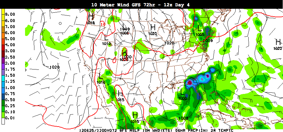
The GFS still forecasts that it will drift north and then northeast, crossing the Florida Peninsula. Here is its 72 depiction (7 a.m. CDT Monday).
The role of Lee Corso is being played by the European. “Not so fast, my friend,” it says. It tosses the mascot head for the future Debby to Texas.
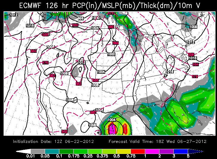
The Canadian is still siding with the ECMWF, predicting a landfall near Corpus Christi as a major hurricane Thursday morning.
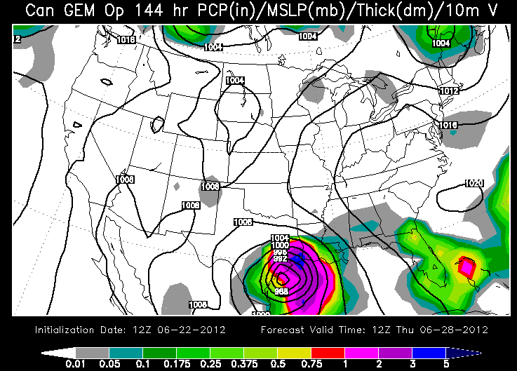
Who will be the top model on this one? It’s a loser leave town smackdown in the numerical weather prediction game.
In either case, it looks like the impact on our weather will be zero. There will be rough surf and rip currents along the Alabama/Northwest Florida coast however and depending on the track, some rain and wind as well, but no major problems expected at this time. Still, all residents around the Gulf are being advised by the National Hurricane Center to monitor the future information on this system.
ALABAMA UPDATE
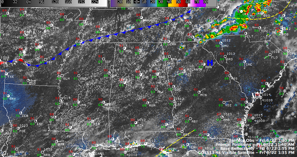
Lots of puffy cumulus clouds across Alabama. It’s quite warm, with temperatures now in the 90s area wide. It was 95F at Huntsville last hour. You can see the southeastward bound cold front in the graphic. It is triggering isolated storms from northeast Georgia back through the Carolinas. We still could see a few isolated storms into Alabama this afternoon, especially over northeastern sections of the state. Otherwise, just hot.


