


RADAR CHECK: As expected, showers are few and far between across the northern third of Alabama this afternoon… but we do have a few heavier storms south of I-20 as I write this update at 3:15p CT. Heavy rain was falling over parts of Shelby County, and in the broad zone from Montgomery over to Alexander City and Opelika. Storms are moving slowly to the south, and will fade away later this evening once the sun goes down. Temperatures are in the low 90s in most places, but of course it is cooler where thunderstorms have formed.
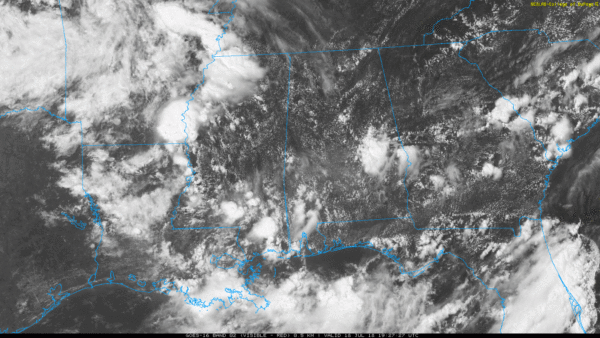
TOMORROW/FRIDAY: The weak surface front across Central Alabama will dissipate, and we expect a partly sunny sky both days with “scattered, mostly afternoon and evening showers and thunderstorms”. Afternoon highs will be in the 90-93 degree range.
THE ALABAMA WEEKEND: A disturbance rolling down the back side of an upper trough over the eastern U.S. will have the chance of pushing an organized batch of thunderstorms into Alabama at some point late Friday night or Saturday morning. Model data suggests the main window will come from 3:00 a.m. until 12:00 noon Saturday. With good dynamic forcing, which is rather unusual for July, some of the storms could produce strong winds and hail. We can’t even rule out an isolated tornado, so we will be watching radar trends closely as the weekend begins.
But, it won’t rain all day Saturday and the sun should be out at times. Then, on Sunday, expect a partly sunny sky with just a few widely scattered showers or thunderstorms. The high Saturday will be close to 90, followed by mid to upper 80s Sunday.
NEXT WEEK: It looks like temperatures will be below average much of the week with highs in the 80s. Days will be partly sunny with some risk of scattered shower and storms on a daily basis. See the Weather Xtreme video for maps, graphics, and more details.

TROPICS: All remains quiet across the Atlantic basin, and tropical storm formation is not expected through the weekend.
BEACH FORECAST: Click here to see the AlabamaWx Beach Forecast Center page.
WEATHER BRAINS: Don’t forget you can listen to our weekly 90 minute netcast anytime on the web, or on iTunes. This is the show all about weather featuring many familiar voices, including our meteorologists here at ABC 33/40.
CONNECT: You can find me on all of the major social networks…
Facebook
Twitter
Google Plus
Instagram
Pinterest
Snapchat: spannwx
Look for the next Weather Xtreme video here by 7:00 a.m. tomorrow…



