


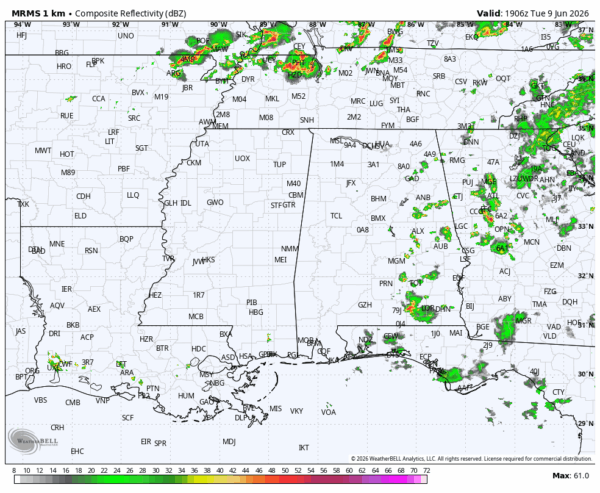
RADAR CHECK: We have a few isolated showers and storms over the eastern third of the state this afternoon, mostly south of I-20 and east of I-65. The rest of the state is hot and humid with a partly sunny sky. A number of communities have reached the 90 degree mark. Isolated showers over East Alabama will end soon after sunset.
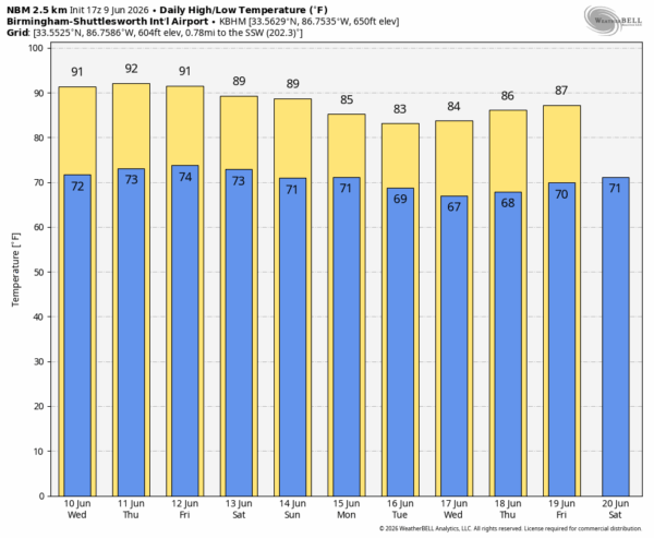
The weather won’t change much through Friday. Hot, humid days with highs in the 88-92 degree range and only isolated afternoon and evening showers/thunderstorms.
THE WEEKEND: The air aloft will be a little cooler, meaning higher instability levels and a slow increase in the number of scattered showers and thunderstorms. The weekend won’t be a wash-out at all, just keep in mind you will have the risk of a passing shower or storm both days, especially in the noon to midnight window. Afternoon temperatures will peak between 86 and 90 degrees with a mix of sun and clouds.
The upper ridge will continue to weaken next week, meaning we will most likely have scattered to numerous showers and storms on a daily basis during the first half of the week… See the video briefing for maps, graphics, and more details.
TROPICS: All remains quiet across the Atlantic basin and tropical storm formation is not expected for at least the next seven days.
ON THIS DATE IN 1972: A cloudburst along the eastern slopes of the Black Hills of South Dakota produced as much as 14 inches of rain resulting in the Rapid City flash flood disaster. The rains, which fell in about four hours time, caused the Canyon Lake Dam to collapse. A wall of water swept through the city claiming 238 lives.
Look for the next video briefing here by 6:00 a.m. tomorrow…



