


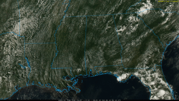
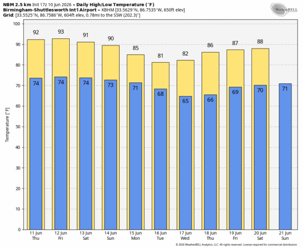
HOT JUNE AFTERNOON: Temperatures are generally in the 88-92 degree range across Alabama this afternoon with a partly to mostly sunny sky. Showers are almost impossible to find on radar… tonight will be mostly fair and muggy with a low in the low to mid 70s.
We expect little change tomorrow and Friday; hot and humid with just a few isolated afternoon showers. A front could bring a band of showers and thunderstorms down into the Tennessee Valley late Friday or Friday night.
The upper ridge over the region will weaken over the weekend, making the air more unstable, and opening the door for an increase in the number of showers and thunderstorms. Best chance of rain will be in the noon to midnight window, and the highest coverage of rain will likely be on Sunday. Still, the sun will be out at times. and highs will be stay in the upper 80s and low 90s.
NEXT WEEK: An upper trough and approaching front will bring numerous showers and storms to Alabama Monday. Rain could be heavy at times Sunday and Monday and we will watch to watch for any flash flooding issues. On Tuesday drier air will begin to move into North Alabama; most of the showers are storms will be over the southern half of the state. The latter half of the week looks relatively dry with cooler nights and lower humidity levels… See the video briefing for maps, graphics, and more details.
TROPICS: A broad area of low pressure could form over the Bay of Campeche late this week from a westward-moving tropical wave. Conditions are not expected to be favorable for significant development, and the system should move inland over eastern Mexico late this weekend. The chance of development is only 10 percent, and the rest of the Atlantic basin is quiet.

ON THIS DATE IN 2008: A potent severe weather outbreak hammered northern New York and Vermont, producing over 50 reports of severe weather, widespread power outages, and wind gusts up to 80 mph.
Look for the next video briefing here by 6:00 a.m. tomorrow…



