


Daily Weather Briefing
Monday, July 27, 2026
ALABAMA THIS MORNING
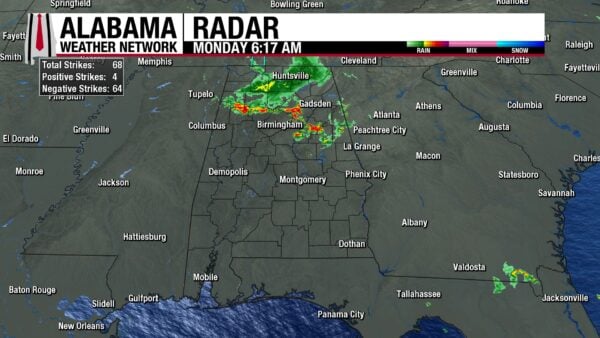
Strong to severe thunderstorms push through the northern half of the state this morning, with two Severe Thunderstorm Warnings that were in effect for Marion and Fayette Counties until 6:15 a.m. To the west of these storms, a few Special Weather Statements are in effect for stronger, but not severe thunderstorms. Thunderstorms stretch from Guin to Oneonta, then south into Childersburg and east to Ranburne this morning. Behind these storms, a large swath of showers encompasses most of north Alabama, excluding most of Colbert and Lauderdale Counties, as well as much of DeKalb and Marshall Counties. Except for a stray shower in Coosa County, the southern half of Alabama is completely dry, but cloudy. Temperatures range from the mid to upper 70s across the state this morning.
ALABAMA 7 DAY FORECAST
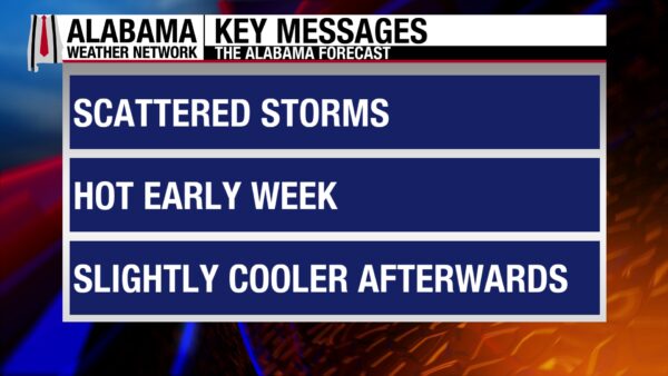
Showers and thunderstorms move through the northern half of the state this morning, then move into the southern half of the state this afternoon. No severe weather outlooks are in place from 7 a.m. onward, but a strong thunderstorm or two is possible statewide today. Heat will also be a concern today. Tomorrow will be mostly dry as convection is suppressed by the upper-level ridge we sit on the eastern edge of. It will be the hottest day of the week as the absence of showers and heavy cloud cover will allow the state to heat up easily. Heat tries to ease up in the northern half of the state Wednesday, and scattered showers are possible. Storms that develop in the southeast in the afternoon will have a low chance of being severe. We’ll end the week with isolated to scattered rain chances and less hot highs. Rain chances pick up slightly this weekend before a cool-off is possible on Sunday.
STORMS NORTH THIS MORNING, SOUTH THIS AFTERNOON – July 27
The showers and thunderstorms present over north Alabama right now will continue and push into central Alabama throughout the rest of this morning. There is a low chance a storm or two could become severe through 7 a.m. this morning, but otherwise, thunderstorms will be run-of-the-mill. A few could be strong and could produce strong winds, heavy downpours, and frequent lightning. Then through the afternoon, the storms will move to the southern half of the state and have the chance to redevelop to be on the stronger side. No severe weather outlooks exist for the region, so storms that do develop will just have the potential to be strong and bring the same strong winds, heavy rain, and lightning they’re capable of producing this morning. The northern half of the state could see an isolated storm linger this afternoon, but the focus will be on the south.
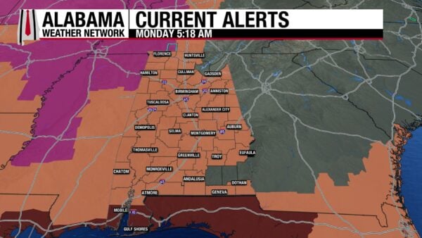
Regardless of rain and storms, Alabama will be hot today. As the upper-level ridge to our west starts to push its eastern edge into our region, highs will easily rise to the low to mid 90s north, the mid 90s centrally, and the mid to upper 90s in the south. Heat indices (feels-like temperatures) will range from 105-112 across Alabama, hence the Heat Advisory that is in effect for most of the state today.
HOTTEST DAY OF THE WEEK TOMORROW – July 28
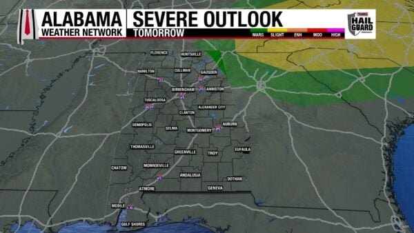
Tomorrow will feature just isolated showers and thunderstorms in the afternoon across the state as heat will be the main story. With the ridge’s influence expected to be strongest tomorrow, highs will rise into the upper 90s across most of the state, with some of eastern Alabama barely holding onto the mid 90s. A location or two in south Alabama will reach 100-degree temperatures. This will allow feels-like temperatures to range from 105-115 degrees, the higher end of that range reserved for the Mobile region. These will certainly be the hottest temperatures of the summer so far, and there will be little relief from rain or cloud cover. Any storms that do develop in the northeast corner of Alabama have a very low, but non-zero chance of becoming severe and producing damaging winds. The Storm Prediction Center has placed the eastern portions of Jackson, DeKalb, and Cherokee Counties under a Marginal (1/5) Risk of Severe Thunderstorms.
HEAT BEGINS TO RELEASE ITS GRIP WEDNESDAY – July 29
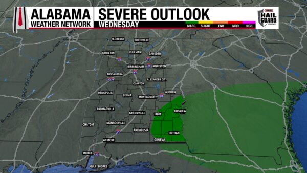
Luckily for Alabama, this heat will not be prolonged. A cold front will push through the state on Wednesday, pushing showers and storms through Alabama during the day. This rain will keep highs limited to the low 90s in the northern half of the state and the mid 90s in the southern half of the state. As the front pushes into south Alabama, there is a low chance that storms in the southeast develop into strong to severe thunderstorms that could produce damaging winds, heavy rain, and frequent lightning, so the Storm Prediction Center has a Marginal Risk in place over the region.
DRIER TO END THE WEEK – July 30-31
The front will bring drier air to Alabama, with little to no rain chances in the northern half of the state and 20% in the southern half of the state on both Thursday and Friday. Highs will hit the low 90s in the northern half of the state and the low to mid 90s in the southern half on Thursday. A similar temperature spread is anticipated for Friday.
PATTERN CHANGE THIS WEEKEND – Aug 1-2
We see rain chances briefly increase on Saturday, and highs will only hit the upper 80s and lower 90s across the state. Then Sunday, rain chances will decrease again, and highs may only reach the mid to upper 80s over the entire state.
RAINFALL OUTLOOK
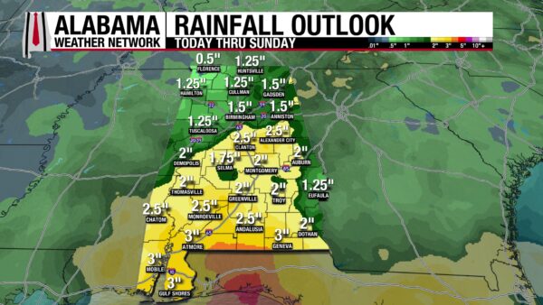
Alabama will receive quite a decent amount of rainfall over the next week. The northern half of the state could receive anywhere from half an inch to 2 and a half inches of rain. The southern half of the state could receive even more, as it expects an inch and a quarter to 3, maybe 4 inches of rain.
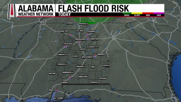
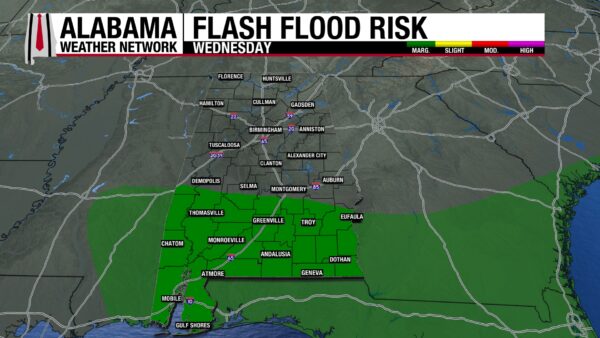
The most northern slivers of Jackson, Madison, and Limestone Counties have a Marginal Risk (1/4) for Flash Flooding today as storms that move through will bring heavy rainfall and could cause flash flooding of low-lying areas. On Wednesday, South Alabama has a Marginal Risk for Flash Flooding as the front will push through and bring storms that could produce heavy rainfall.
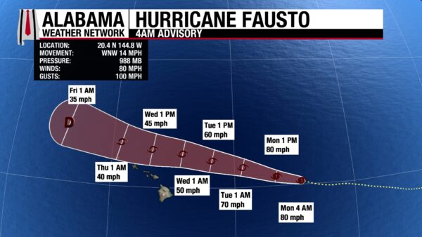
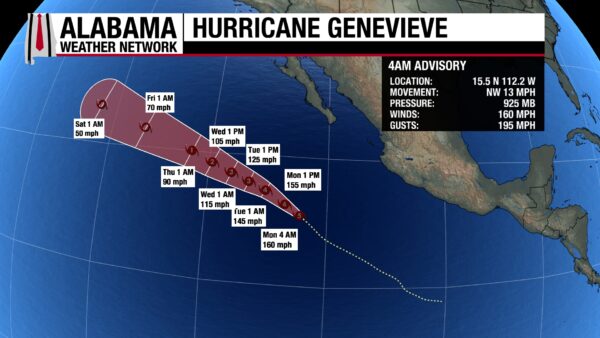
2 PACIFIC HURRICANES
Hurricane Fausto has sustained winds of 80 mph and a central pressure of 988 mb and has weakened since yesterday morning. It will continue to weaken today, falling to tropical storm status by this evening as it continues its west-northwest track toward Hawaii. Most of the stronger winds and heavy rains will stay to the north of Hawaii, but some of the smaller islands could feel tropical storm-force winds on Wednesday, and surf will be rough for the state as a whole.
Hurricane Genevieve has reached Category 5 status with winds of 160 mph and a central pressure of 925 mb. It is the first Category 5 hurricane in the Pacific since Hurricane Kristy in 2024! Although it is forecast to weaken to Category 4 status later today, it will continue to be an incredibly strong hurricane through the beginning of the week, until it weakens to Category 2 status around Wednesday. By this weekend, Genevieve is expected to be a tropical storm, and no land impacts with this system are anticipated through its life cycle.
The area of interest we were watching has formed into Tropical Storm Dolphin but has moved too far west to still fall under the jurisdiction of the National Hurricane Center. Updates for the storm will now come from the Joint Typhoon Warning Center (JTWC) and the Japan Meteorological Agency (JMA).
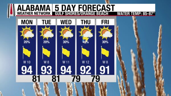
GREAT WEEK ON THE BEACH
The weather on the Alabama coast this week will be perfect for summer beach-enjoyers. The high will be in the low to mid 90s (mid 90s today), with mostly sunny skies and a Very High to Extreme UV Index (Very High today). Winds will blow from the west at 10 to 15 mph, and rain chances will stay between 20-40% each day. The rip current risk remains Low through the week, and the surf height will stick between 1 and 2 feet, opting for around 2 feet today.
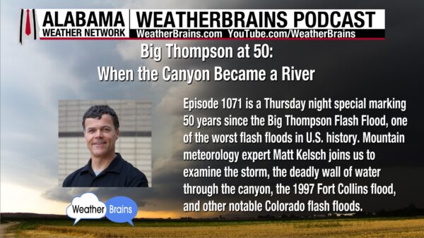
WEATHERBRAINS 1071
Today’s episode features Mountain meteorology expert Matt Kelsh to talk about the 50th anniversary of the Big Thompson Flash Flood. The episode was recorded Thursday as James Spann takes a vacation this week. Listen wherever you get your podcasts or watch the episode here.
TODAY IN WEATHER HISTORY
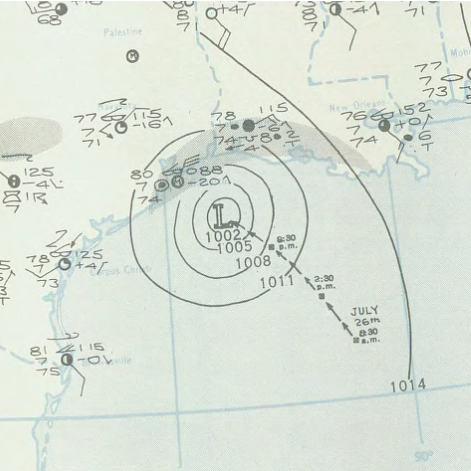
July 27, 1943 – The Surprise Hurricane
On July 27, 1943, a hurricane moved into the Houston-Galveston area at one of the most difficult times imaginable for weather forecasting. The United States was deep in World War II. Fewer ships were sending routine weather observations because of German U-boat danger, and some vessels maintained radio silence. In a time before satellites, radar networks, and routine Hurricane Hunter missions, forecasters were missing some of the information they needed most.
The storm was small, intense, and poorly observed as it approached the upper Texas coast. Early public advisories described a tropical disturbance or small tropical storm, not a major threat. By the time the Category 2 hurricane struck the Bolivar Peninsula, Galveston Bay and Houston, the warning picture had changed too late for many people in the path. Galveston, Texas City, Baytown, La Porte, Deer Park and Houston all felt the storm’s compact but powerful core. Ellington Field recorded a pressure of 974 millibars, and gusts to 132 mph were reported in the Houston area.
Across the region, 19 people were killed, and damage was estimated at $17 million in 1943 dollars. Refineries and industrial sites along the Houston Ship Channel were producing aviation fuel and other materials important to the Allied war effort, so damage to those facilities was treated as sensitive information. Reports say the only news appeared in Texas and Louisiana, and there was even an account of the FBI shutting down a La Porte telegraph office after someone sent damage information out of state.
But the same storm also changed hurricane science. At Bryan Field, about 100 miles inland, Colonel Joseph Duckworth heard the hurricane was moving toward Galveston. Duckworth was an instrument-flying instructor, and he saw the storm as a test. He and Lieutenant Ralph O’Hair first took off in a single-engine AT-6 Texan trainer and flew into the hurricane. The turbulence was violent, but they broke into the calm eye, circled briefly, and returned safely.
When they landed, the base weather officer wanted to see it for himself. Duckworth took off again, this time carrying Lieutenant William Jones-Burdick, who made detailed observations inside the storm. Those flights proved aircraft could survive hurricane penetration and return useful information. The 1943 Surprise Hurricane left two legacies: public hurricane warnings could not be hidden from people in danger, and aircraft reconnaissance could give meteorologists direct information from the heart of a storm.
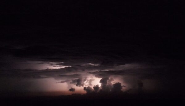
IMAGE OF THE DAY
Skywatcher Daniel Harbin captured this cool photo of lightning illuminating a cloud as lightning lit up the Alabama/Georgia state line earlier this morning.



