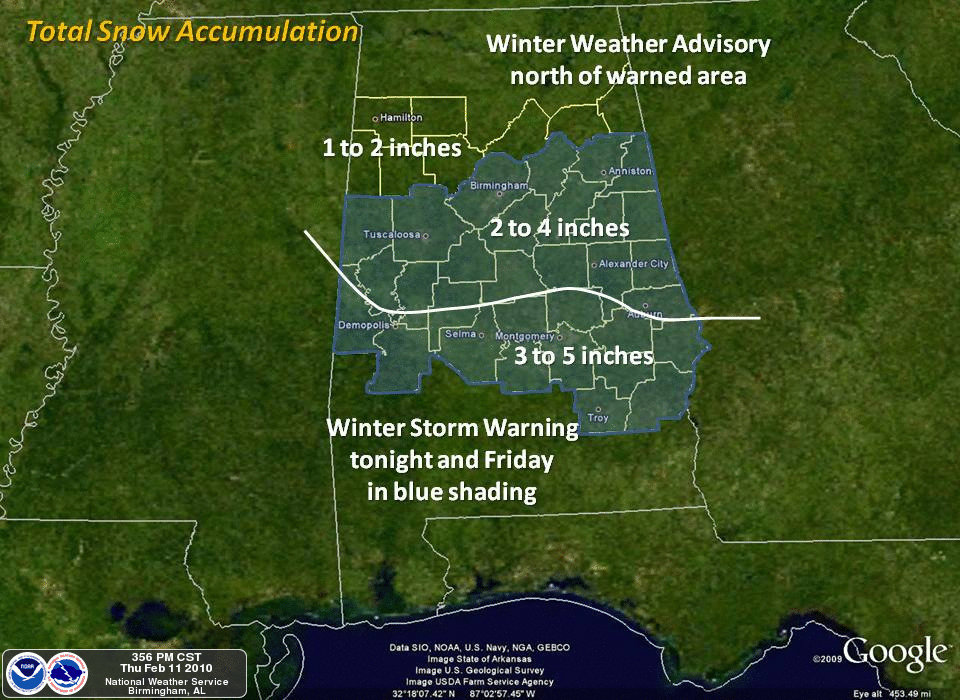
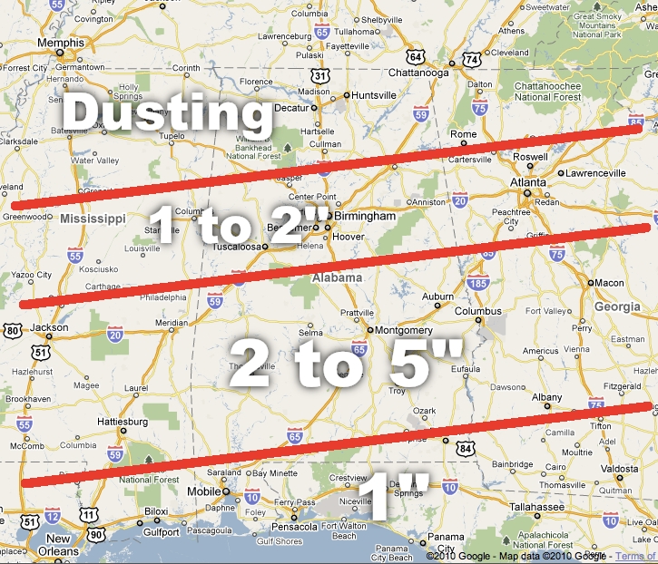
Below is a comparison of the NWS accumulation, and the one I put together earlier (mine is the one on top)… you can see the NWS is a little more aggressive with snow the I-20. One way or another, the heaviest snow should be over the southern half of Alabama tomorrow. We will talk about this on the live stream at 7:00….
Published on: February 11, 2010 at 6:05 PM
Related Articles
June 30, 2026 at 5:41 AM
Hot Summer Weather; A Few Spotty Afternoon Storms
SUMMER HEAT: Afternoon highs will remain in the 90s across Alabama through the rest of the week, with triple digit heat index values during the afternoon hours. A “heat advisory” is in effect for the state. During the peak of … Continue reading →
READ MORE
June 22, 2026 at 5:35 AM
Strong Storms Possible Across Alabama Later Today
ACTIVE DAY: Some rain is falling across the northwest corner of Alabama early this morning… the rain is more widespread to the north over western and middle Tennessee. Showers and storms are likely over North Alabama by mid to late … Continue reading →
READ MORE