


FAY STRONGER…WATCHES ISSUED
FAST FACTS…at 5 a.m. CDT…Tropical Storm Fay was located near…
LOCATION….LAT 19.7 LON 77.3 or 445 miles SE of Key West
MOVEMENT…W-13 (Expected to turn more northwest and slow)
TOP WINDS…50 mph (Strengthening expected)
CENTRAL PRESSURE…1003 millibars
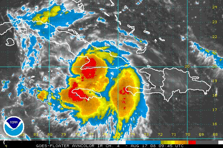
FAY STRENGTHENING SLOWLY
Convection is definitely forming near the center, which is over water hugging the south coast of Cuba. Fay is over water that is 29-30C, and thatis high octane fuel for a hurricane. Without the interaction with the land and high terrain of Cuba, this would be a rapidly intensifying hurricane.
WATCHES
A hurricane watch has been issued for the Keys and Southwest Florida, including Ft. Myers. A tropical storm watch is in effect for South Florida, generally south of the Keys. For Cuba…a hurricane watch for central sections and a tropical storm warning for eastern sections. Tropical storm watches for Caymans, Bahamas and Jamaica.
MANDATORY VISITOR EVACUATION FOR KEYS
Starting at 8 a.m. EDT this morning. Word is that a general mandatory evacuation order will not be issued. Residents in mobile homes and low lying areas are expected to be mandated to find safe shelter.
GFS
The 00z run of the GFS from last night has nudged the track of Fay a tad to the left, taking it near Key West Monday afternoon, then slowly up the west coast of Florida to a point north of Tampa late Tuesday night. It then moves into North Florida, South Georgia and eventually into North Carolina. Interestingly, this run makes us much wetter in Alabama on Wednesday with a trough to the west and Fay to our east.
OTHER MODELS
GFDL…track is further east of the GFS with a landfall near Naples as strong tropical storm…then across Peninsula, back out into the Atlantic for another landfall near Myrtle Beach.
CANADIAN…in line with the GFS
HWRF…also in line for GFS
UKMET…a little west of the GFS/Canadian/HWRF…taking ti to east of Tallahassee
NOGAPS STILL OUTLYER
The NOGAPS model still predicts a landfall along the Alabama/Mississippi coast
OFFICIAL TRACK
Still holding to the idea of a West Florida track…carrying the center over Key West late Monday night…inland near Ft. Myers Tuesday morning, then up the Peninsula into South Georgia Wednesday night.
ANOTHER SYSTEM?
The GFS has picked up on the idea that we saw in the Canadian yesterday, bringing another tropical system toward South Florida by next Sunday.



