


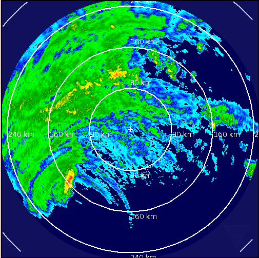
Fortunately, Hurricane Igor has been slowly weakening. It still has top winds of 85 mph and is expected to hold that intensity until it passes the island nation of Bermuda tonight. In fact, there seems to be a little burst of convection around the center right now that could signify even a brief intensification.
It is about 100 miles south southwest of the island, moving north at 16 mph.
Things have been going downhill on Bermuda since last night. The island is being buffeted by strong tropical storm force winds now. At 2 p.m. AST, winds were from the east at 54 mph gusting to 67 mph with rain and blowing spray. The temperature was 77F with a dewpoint of 75F.
Just before 4 p.m. local time, winds gusted to 74 mph. A surge of 2-5 feet above normal tide levels is expected on the island.
The center is expected to be around 20 miles west of the island at its closest approach, which should occur at 7 p.m. CDT or 9 p.m. local (AST) time this evening. Winds could be above 80 mph on the island then. Hurricane force winds could occur for a few hours beginning late this afternoon.



