


Two convective bands have merged over Mississippi this morning, producing one band of intense rainfall that is falling at the rate of 1-3 inches per hour. Several large flash flood warnings ave been issued for Mississippi counties.
Look at this image from the Columbus radar:
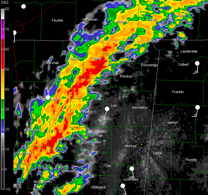
The band is only slowly moving to the east, resulting in training of heavy rain over the same areas for extended periods.
The source for the heavy moisture is coming all the way from the eastern Pacific across the Yucatan and Gulf and is pointed like a firehose at the Deep South.
Thanks to our friend, satellite expert Sheldon Kusselson from NOAA NESDIS (who will be on WeatherBrains this Tuesday night by the way) for sharing this image this morning.
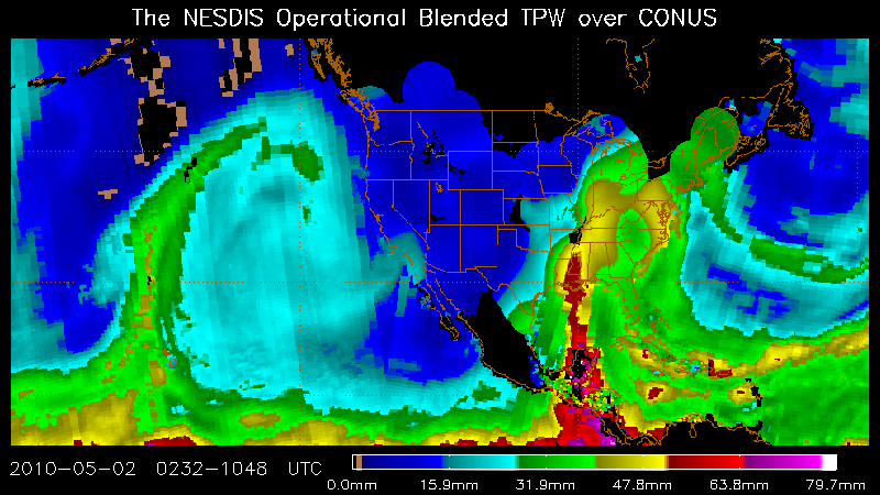
Those values over Mississippi are some 200% of normal!
This means more heavy rain for Mississippi, gradually sifting into Alabama during the day.
The NWS has been discussion the situation across Alabama with us over the past few minutes. The atmosphere is capped at two levels, making it difficult for storms to form out ahead of the main forcing back over Mississippi, despite the rich moisture and warm air. This is the reason that we are in their standard risk outlook today (slight) when it looked like we might fall into a moderate risk today.
If those caps hold, we may escape seeing supercells form out ahead of the heavy rain/thunderstorm band over Mississippi. We would still see torrential rains, damaging winds from bowing segments, and tornadoes associated with mesovortices and embedded supercells.
But with a few breaks in the clouds could heat the atmosphere up to produce a few individual supercell storms later today, and those could produce stronger tornadoes.
Get ready for lots of flash flood warnings later today and tonight, and the potential for severe thunderstorm and tornado warnings as well. Stay tuned to the weather throughout the day.



