


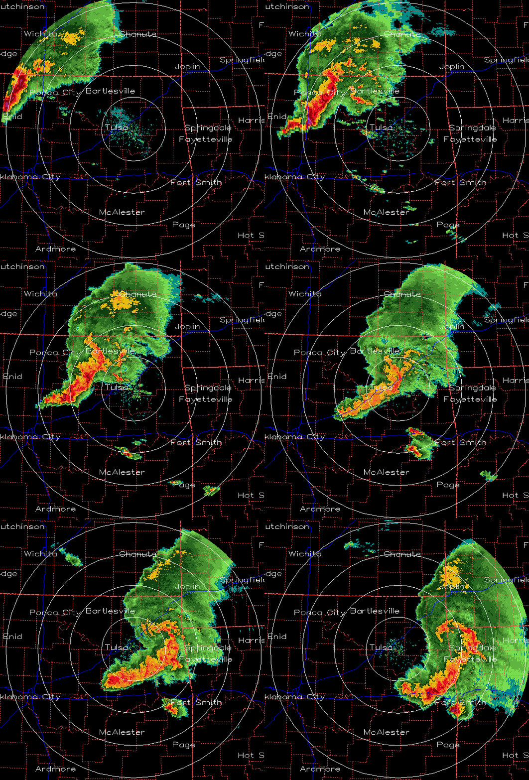
Above is about a 4-hour radar loop of the derecho/bow echo coming across Oklahoma and into Arkansas. Notice the swirling motion near the northern end of the complex of storms…that is typical due to several reasons, one being the fact that, with the strongest winds blowing toward the SE in the middle of the line, it’s like a paddle in the water…little vortices spin off the edges when you paddle. Also notice the supercell storm NE of McAlister. It splits into two separate storms and one heads north! Fascinating dynamics.
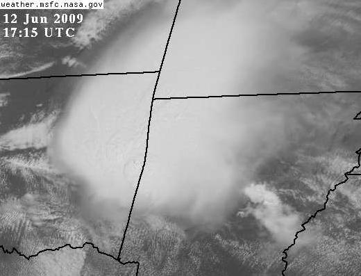
The high-resolution visible satellite image shows an almost 3D image of the storms, with some updrafts buoying above the main cloud top.
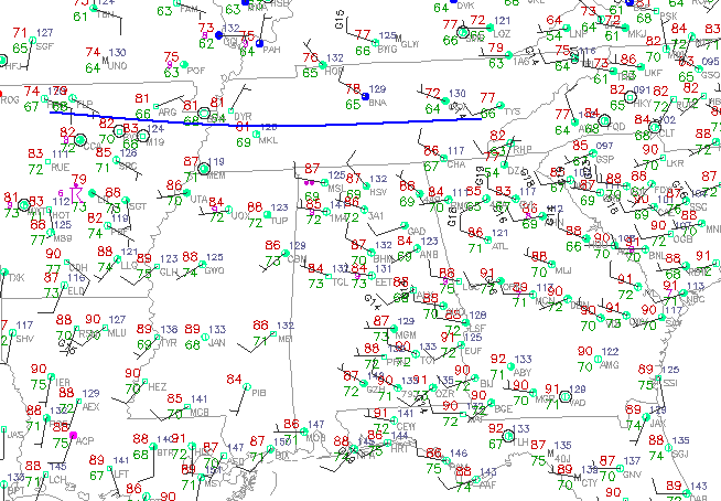
JB and Brian discuss the potential for this complex to reach Alabama later below. Adding a few graphics, take a look at the surface chart and notice that there is a cold front (blue curve) in Tennessee.
Looking at CAPE values (the instability of the atmosphere, with any number over 1,000 J/kg supporting storms), one can see a huge area of instability ahead of the storms moving through Arkansas now, with CAPE above 3,500 J/kg in a large area from southern Arkansas to central Alabama. The large gradient in CAPE over Tennessee indicates the location of the cold front nicely here.
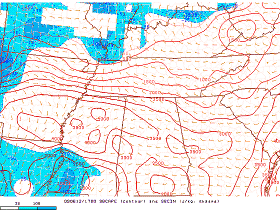
(SPC)
As for Alabama, our air is already so humid and unstable, expect scattered storms, a few producing damaging winds and/or large hail, to develop over the next hour or two. It is difficult to say whether the large complex of storms in Arkansas will make it here or not. These thunderstorm complexes usually follow frontal boundaries (we have one just north of us), and need unstable air (we have plenty). They also tend to last longer in environments with vertical wind shear, and we don’t have much of that. So, we’ll have to watch it closely over the next few hours. If it does make it to Alabama, it should be after 6 pm in west Alabama, and between 8 pm and midnight in BHM.
For your meteorological consulting needs, Coleman and Peters, LLC, can provide you with accurate information on past hailstorms, lightning, flooding, and wind damage. We work primarily for people involved in insurance cases and for attorneys. Please call us at (205) 568-4401.



