


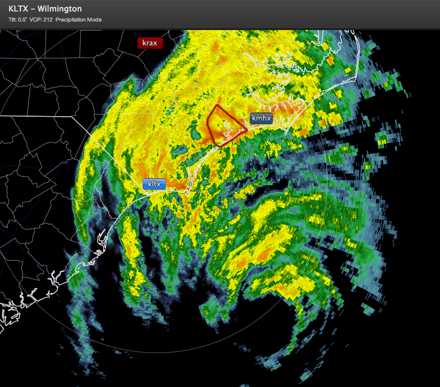
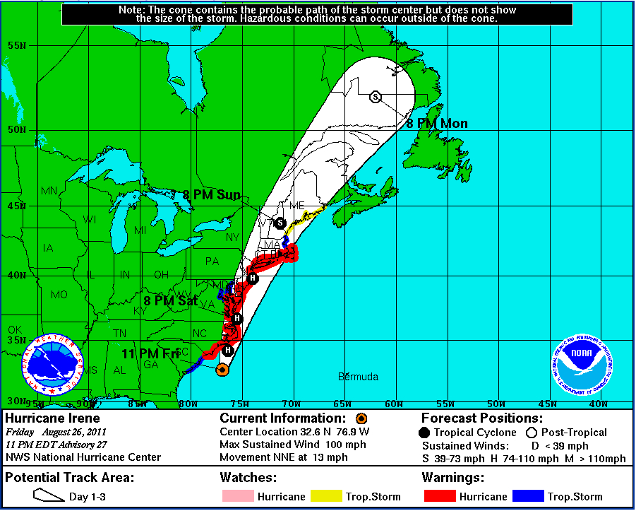
Here is the latest on Irene as of 10 p.m. CDT:
LOCATION…32.6N 76.9W
ABOUT 140 MI…225 KM S OF CAPE LOOKOUT NORTH CAROLINA
ABOUT 195 MI…315 KM SSW OF CAPE HATTERAS NORTH CAROLINA
MAXIMUM SUSTAINED WINDS…100 MPH…160 KM/H
PRESENT MOVEMENT…NNE OR 20 DEGREES AT 13 MPH…20 KM/H
MINIMUM CENTRAL PRESSURE…951 MB…28.08 INCHES
METEOROLOGICAL IMPACTS:
The Outer Banks are experiencing tropical storm force gusts this evening and will see sustained tropical storm force winds overnight with some hurricane force winds. Storm surge will run 6 to 11 feet in the sounds along the Carolina Coast.
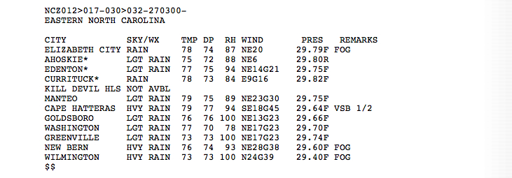
Here are 9 p.m. CDT observations from eastern Carolina.
Tropical storm force winds will spread into southeastern Virginia around Norfolk overnight, and they will see some hurricane force winds late this morning into early afternoon.
The Washington/Baltimore area could see tropical storm force gusts this afternoon. Hurricane warnings are in effect for the eastern Maryland Coast and Lower Chesapeake, although the chance of hurricane force winds is less than 15%. Storm surge is expected to run 1 to 3 feet above normal in the lower and middle Chesapeake. The chances of surge problems at Alexandria and Baltimore is pretty low.
Tropical storm and hurricane force winds will spread up the Delmarva Peninsula Saturday afternoon.
Tropical storm force winds could reach New Jersey by lunch time Saturday and New York City by evening. Hurricane force gusts could be measured in New York City, especially in the higher floors of skyscrapers, by Sunday morning. The main impacts will come on Long Island where landfall will occur, although Irene could be below hurricane strength before it reaches Long Island.
Very heavy rainfall will fall on already saturated ground through eastern Pennsylvania and New Jersey, where record rainfalls have fallen in the past month. Trees will be knocked down in the high winds across the area, thanks to the softened ground.
Coastal flooding will be a problem, with a 3-6 foot surge could affect lower Manhattan, Long Island and New Jersey. Dangerous surf will pound the coast as well.


