


FAST FACTS ON KAREN AT 7 PM
———————————————-
LOCATION…25.9N 90.3W
ABOUT 400 MI SSW OF MOBILE
MAXIMUM SUSTAINED WINDS…50 MPH…85 KM/H
PRESENT MOVEMENT…STATIONARY
MINIMUM CENTRAL PRESSURE…1002 MB…29.59 INCHES
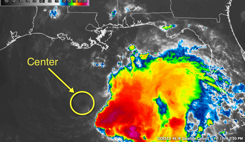
The center of Tropical Storm Karen is totally exposed tonight. All of the convection has been blown off to the east.
The central pressure at 7:10 p.m. was still 1003 mb, but the maximum flight level winds inbound was 31 mph. The SFMR estimate of the surface winds was just 40 mph.
The high flight level wind on this mission was 53 mph at 4:08 p.m.
There is a chance that Karen may be weakening into a tropical depression. It could get absorbed by the approaching trough of low pressure.
If it holds together, there is a chance it could strengthen tomorrow as it turns north and north east ahead of the trough.


