SUMMARY OF 400 PM CDT INFORMATION
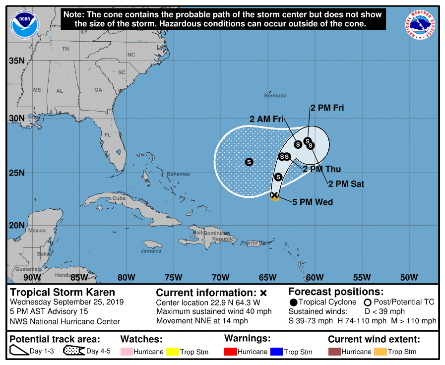
LOCATION…22.9N 64.3W
ABOUT 330 MI…535 KM NNE OF SAN JUAN PUERTO RICO
MAXIMUM SUSTAINED WINDS…40 MPH…65 KM/H
PRESENT MOVEMENT…NNE OR 15 DEGREES AT 14 MPH…22 KM/H
MINIMUM CENTRAL PRESSURE…1004 MB…29.65 INCHES
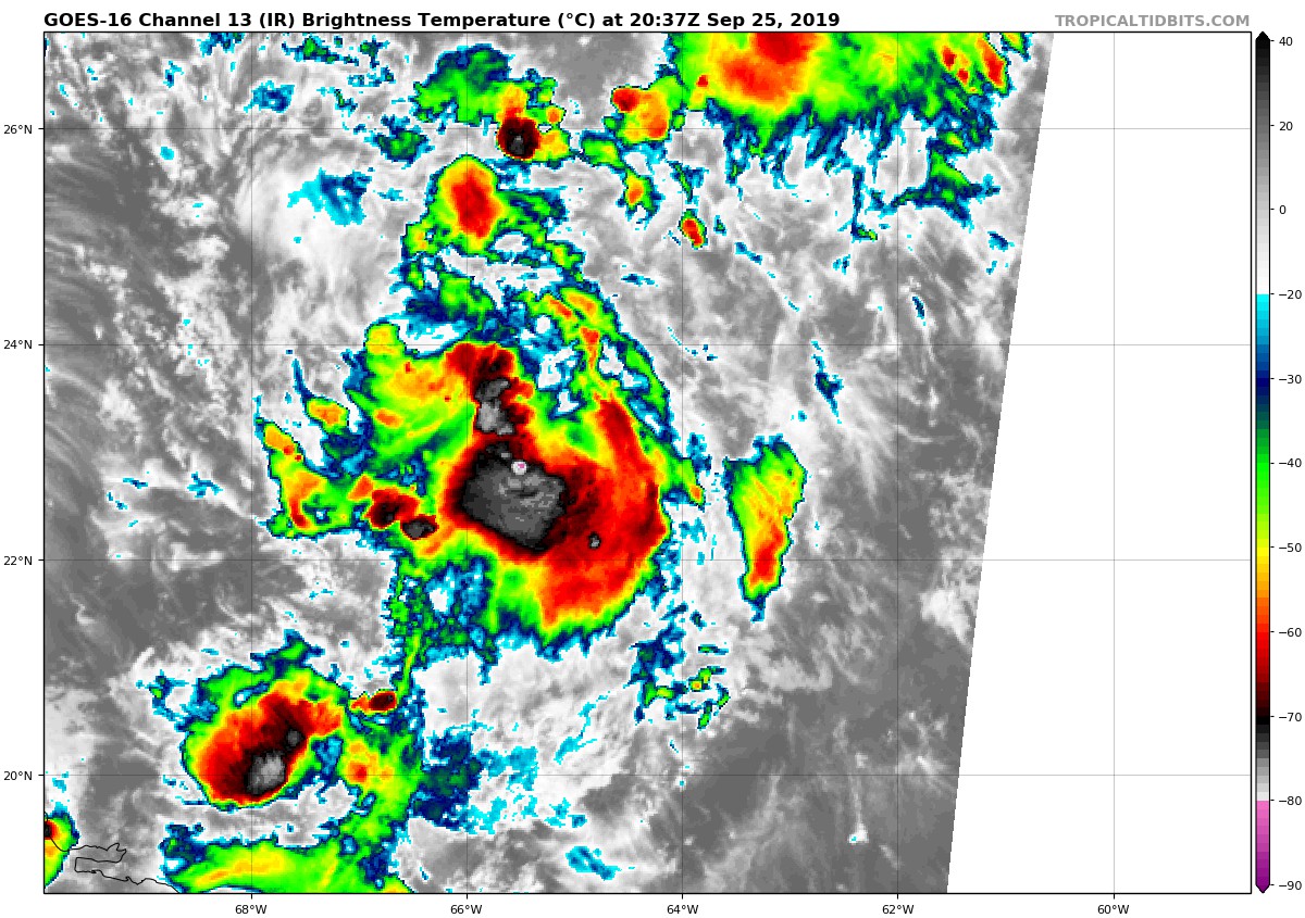
An Air Force Reserve Hurricane Hunter aircraft investigating Karen found maximum 850-MB flight-level winds of 43 kt, and SFMR-measured winds of 34 kt. Although those surface winds were coincident with some heavy rains, which makes them questionable, it is assumed that there are still some tropical-storm-force winds somewhere within the circulation. The initial intensity has been lowered to 35 kt.
Karen has turned toward the north-northeast with an initial motion of 015/12 kt. The cyclone is positioned between a mid-level high centered over the central Atlantic and a mid- to upper-level low spinning just east of the Bahamas. The steering flow between these two features should keep Karen on a generally northeastward trajectory during the next 48 hours. Around that time, a blocking ridge is expected to build to the north of Karen, causing it to make a clockwise loop and move west-southwestward by days 4 and 5. Compared to the previous cycle, the track models are allowing Karen to get farther to the northeast before it makes its loop, which ends up slowing down the 4- and 5-day NHC forecast points. Even with that change, however, the forecast path of Karen is relatively unchanged from before.
It’s probably time to put more weight on the dynamical models for Karen’s future intensity. The cyclone has continued to struggle in its environment, which is essentially what those models have been indicating all along. Even the statistical-dynamical models, which are explicitly showing strengthening, indicate that the environment won’t be very favorable, with convergence aloft and a dry mid-level air mass. Because of those factors, and the lower initial intensity, the NHC intensity forecast has been lowered considerably from this morning’s forecast. It still allows for the possibility of some strengthening, but if model trends continue, the official forecast could be lowered further in subsequent advisories. And if the global models are correct, Karen could even lose deep convection, and hence become post-tropical, in about 3 days.