


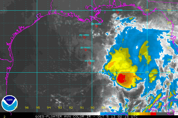
SUMMARY OF 1000 PM CDT…INFORMATION
———————————————–
LOCATION…26.4N 90.5W
ABOUT 330 MILES SOUTHWEST OF MOBILE
MAXIMUM SUSTAINED WINDS…45 MPH…75 KM/H
PRESENT MOVEMENT…NNW OR 340 DEGREES AT 7 MPH…11 KM/H
MINIMUM CENTRAL PRESSURE…1002 MB…29.59 INCHES
Tropical Storm Karen fought tenaciously all day today, her developing convection batting moderate wind shear.
By mid-afternoon, the storm’s vigorous circulation center was completely exposed and it eventually detached totally from the convection, the picture of a tropical cyclone in its death throes. Throughout the afternoon and evening, flight level and surface winds slowly dropped and the central pressure in the storm rose to 1007 mb according to reconnaissance aircraft.
The NHC is maintaining the system as a tropical storm with tops winds of 45 mph since there is still a strong circulation, despite the lack of convection.
As Karen, or its remnants turn to the northeast, The shear that was impacting the storm will weaken. This could allow convection to refire and build. If this happens, Karen could regain strength again.
But there is a good chance that it could weaken into a remnant low and be absorbed by the upper level trough over the next 48 hours. This probably would produce more in the way of rainfall for us in Central Alabama.
We will continue to monitor the system until it is inland.


