


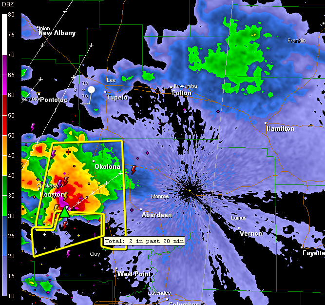
The large storm complex over northern Mississippi passing north of Aberdeen is showing a high probability of severe hail, possibly as large as grapefruit size (4 inches).
We hope that it will weaken as it moves into Northwest Alabama, but no sign of that so far.
The complex is moving northeast very slowly, at about 15 mph. It could be 1 a.m. before it reaches western Marion County.
With an increasing low level jet, this and other activity that develops along a northward moving warm front could be be severe, possibly even producing isolated tornadoes overnight.



