


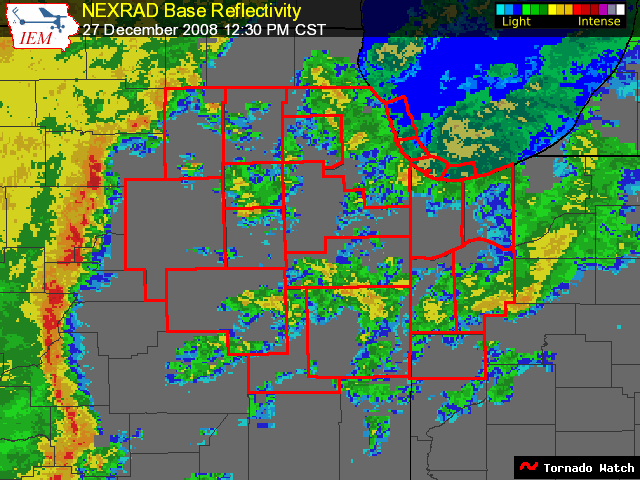
Something you don’t see every day.
There is a tornado warning for four counties in Central Illinois along a QLCS (Quasi Linear Convective System, translation: line of thunderstorms) that has a histoy of producing damaging winds and tornadoes. Shear values are off the chart and widespread wind damage is expected along with isolated tornadoes.
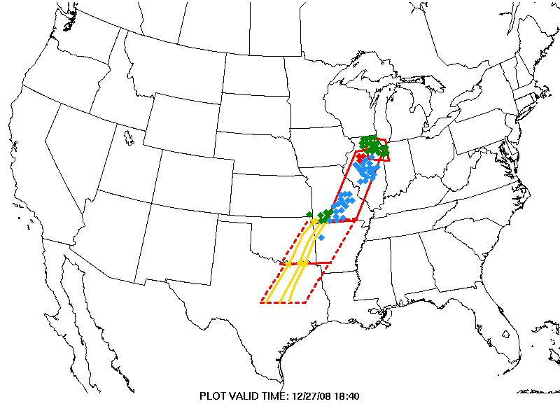
Watches extend southward. Those dotted boxes are watches that will be expiring soon. They will be extended eastward most likely as the front continues to push east.
Record highs are falling like dominoes…
55F at Lansing MI
64F at Erie PA
65F at Bluefield WV
63F at Toledo
69F at Cincinnati
78F at Jackson MS
These are early reports…some of these readings will go even higher. Look for several records to fall in Alabama as well.
Another note…
Grand Rapids MI set a new annual rainfall record this afternoon.



