


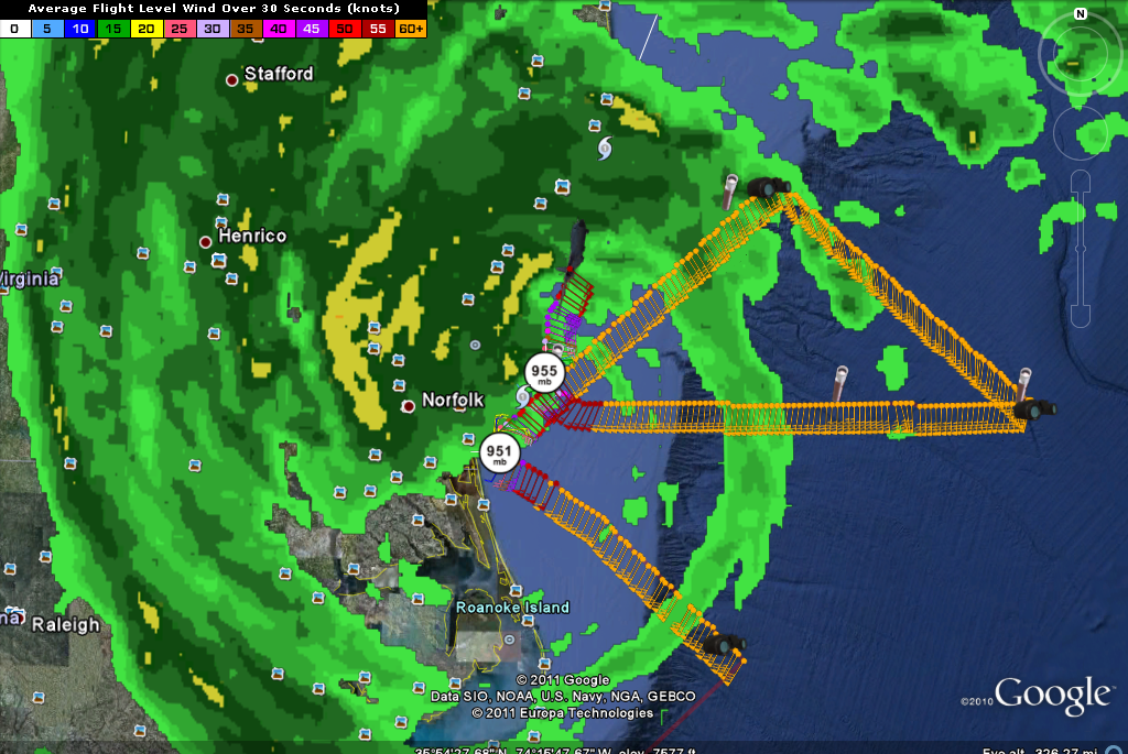
Hurricane Irene continues her northward march tonight along the East Coast. Air Force recon just found a central pressure of 955 mb. They did find a 100 mph flight level wind in the eastern side of the storm. That translates to a 90 mph estimated max surface wind. The crew estimated the maximum surface wind at 74 mph.
So, Irene will probably still be a minimal hurricane on the next advisory at 10 p.m.
A few notes…
…8 deaths so far
TORNADOES
…at least three confirmed tornadoes in Virginia and Delaware. About 15 homes were damaged and 1 destroyed near Lewes in Delaware.
…tornado watches are in effect from Delaware through New Jersey, New York City and Long Island into Connecticut
…several tornado warnings in eastern Pennsylvania and New Jersey around 9:30 p.m. CDT
FLOODING
…several reports of flash flooding in the DC/Baltimore area…
…1 to 3 inches of rain expected to fall in the next 6 hours from the DC area eastward to the Maryland Coast and northward into New Jersey.
…a stationary frontal boundary lines just west of the coastline is focusing the onshore flow ahead of the hurricane and rainfall totals will reach 6-10 inches or higher.
…considerable surge flooding in the Hampton Roads area of southeastern Virginia
…1.13 inches of rain in New York’s Central Park…with 0.52 inches in the past hour
…3.51 inches of rain in Atlantic City…with 1.46 in the last hour
STORM SURGE
…coastal flooding will occur ahead of Irene into New England…including 4-8 feet in New York Harbor and western Long Island…and 3-6 feet in New Jersey. A surge of 1-2 feet could occur tonight in the Tidal Potomac in the D.C. area. Boston could see 3-5 feet in Buzzards Bay and Naragansett Bay.
…still getting 4 feet on soudn side flooding on the back side of the hurricane in Currituck County NC.
WIND – All times CDT
…just had a 71 mph wind gust at Richmond…Willimasburg had a 76 mph wind gust just before 8 p.m.
…winds at Cape Hatteras still gusting to 68 mph last hour
…peak wind so far Ocean City 40 mph…they could see hurricane force gusts through 3 a.m.
…I like that the NWS in Upton (New York City) is making extensive use of probabilities in their Hurricane Local Statement…like saying there is a 10% chance of hurricane force winds in New York City, but there is a 91% of tropical storm force winds.
…Tropical Storm Warning for the Washington/Baltimore area…winds should not get much higher than they are now…last hour…48 mph wind gust at Andrews AFB
…Atlantic City…strong tropical storm force winds with hurricane gusts between 1 a.m. and 7 a.m.
…Philadelphia should not see hurricane force gusts…
…Strongest winds in New York City between 6 a.m. until 10 a.m.
…Boston…could see wind gusts to 50-55 mph.
CLOSEST APPROACH
…about now for DC
…Atlantic City…5 a.m.
…New York City…9 a.m.
…Hartford…1 p.m.
…Boston…3 p.m.


