


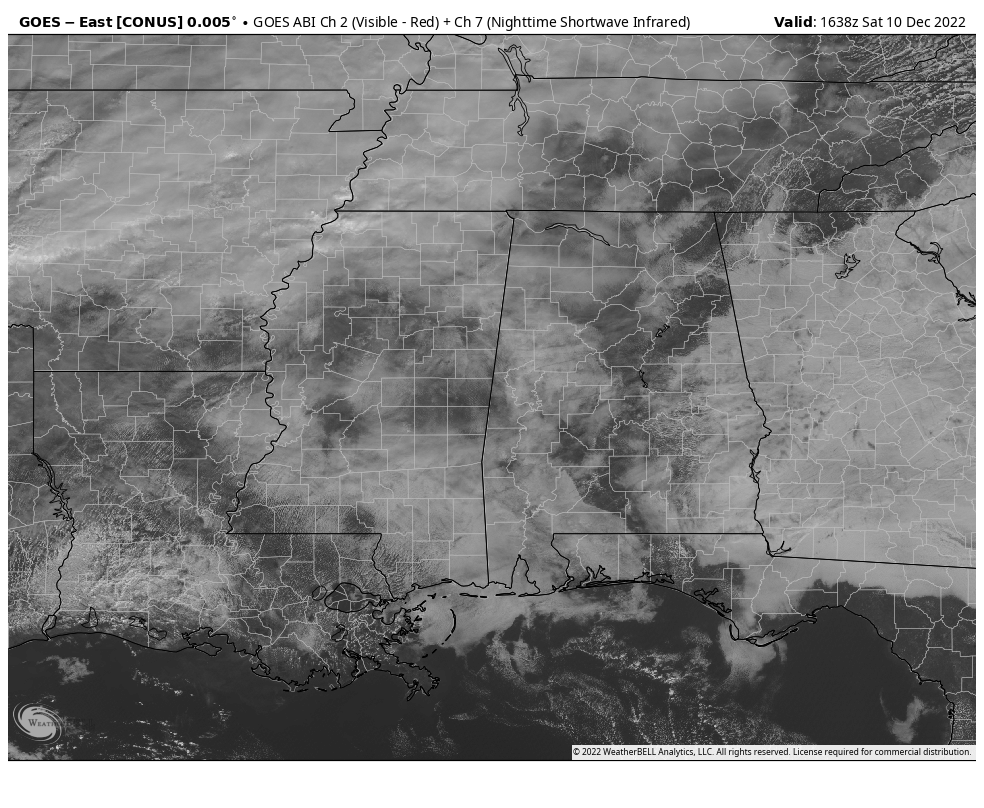
As of 10:45 am, the latest satellite view of the southeast shows much of Central Alabama covered in clouds while there are a few locations are seeing some breaks in those clouds with bright sunshine. For now, there is a lot of noise on radar and I wouldn’t be surprised if a few light showers or drizzle were falling over the northwestern quarter of Central Alabama, but rain chances will start to rise as we get into the afternoon and evening hours.
Temperatures as of the 10 am roundup were ranging from as cool as 52 degrees in Haleyville with light rain, to as warm as 70 degrees in Montgomery with mostly sunny skies. Birmingham had partly sunny skies at 65 degrees.
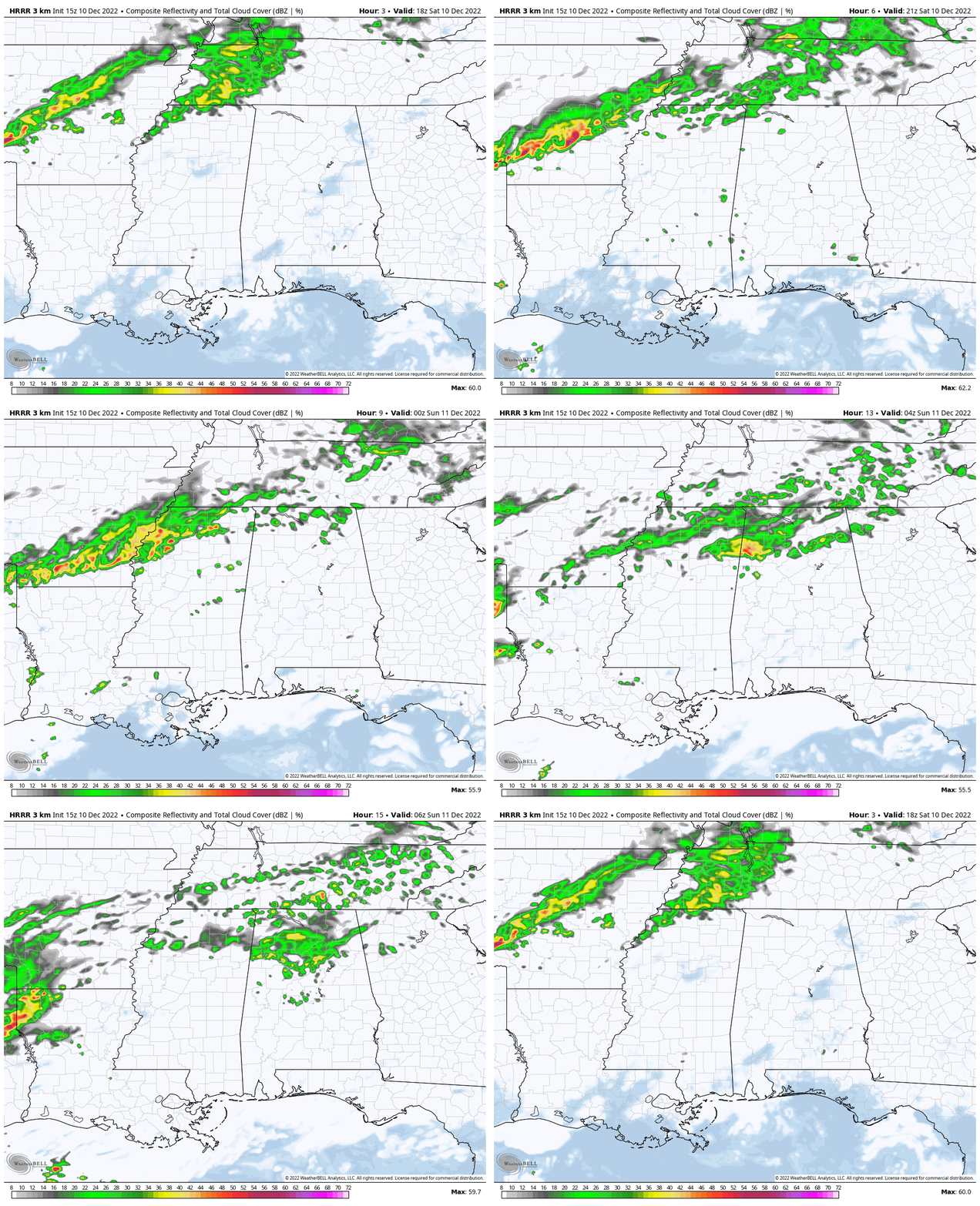
The latest run of the HRRR shows that a few showers will begin to move into the northwest corner of the state during the early afternoon, as a shortwave will be moving along a stationary front. That activity will continue to slowly push into the northern parts of the state and eventually into the extreme northern parts of Central Alabama. By midnight tonight, locations along and north of the I-59 corridor will have a likely chance of showers and maybe one or two rumbles of thunder. We also can’t rule out a few passing sprinkles or light showers out ahead of that activity. Highs will top out in the lower 60s to the lower 70s.
During the overnight hours, the activity will dissipate somewhat, but showers will remain highly possible for the northern half of Central Alabama, while chances will be much smaller for the southern half. Overnight lows will be in the mid 50s to the lower 60s.
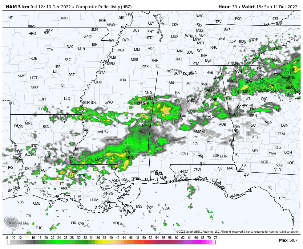
We will continue to have showers and a few rumbles of thunder likely through the day on Sunday as that shortwave continues to move slowly southward. By midday, much of the activity will be along the I-59 corridor and south, with a good bit of the activity dissipating as we reach the evening hours with the shortwave reaching the I-85 corridor. Highs in the lower 60s to the lower 70s.
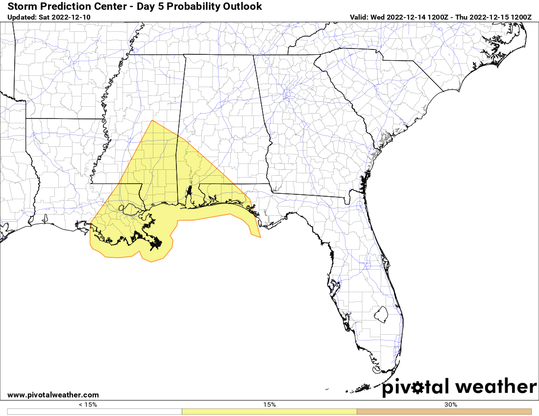
And taking a quick look ahead to the next storm system that will roll in here late Tuesday and through the day on Wednesday, the Storm Prediction Center has pretty much kept the severe weather outlook the same for day five, with the projected slight risk mainly along and south of a line from Cuba to Sweet Water. A few damaging wind gusts and an isolated tornado or two may be possible. The rest of Central Alabama has not been placed in a defined risk of severe storms. We’ll keep you updated.



