


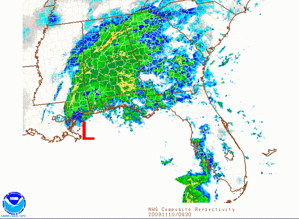
The center of tropical storm Ida remains just offshore of the Mississippi Coast early this morning. It is centered about 35 miles south of Pascagoula, MS. It has definitely slowed its forward motion. Now the question is whether it will even make landfall as a tropical system.
Ida, or its remnants, are expected to begin moving eastward later this morning, exactly as predicted very early on by the NHC. Their forecasts have been excellent.
But where the center goes is kind of academic now. It’s windy and wet across a large part of the Gulf Coast and inland sections of Alabama and Mississippi.
Rain covers a large part of Alabama tonight. The back edge of the rain is now moving up into Marengo, Wilcox and Butler Counties in South Alabama. This large rain area will continue through the overnight hours, finally moving east later today. 1-2 inches of rain could fall overnight and tomorrow morning in the I-59 corridor. 3-4 inches could fall from Mobile to Anniston. Flash flood watches are in effect just in case.
Only 0.29 inches so far at the Birmingham Airport through midnight. I’ve had 0.31 inches here in Trussville.
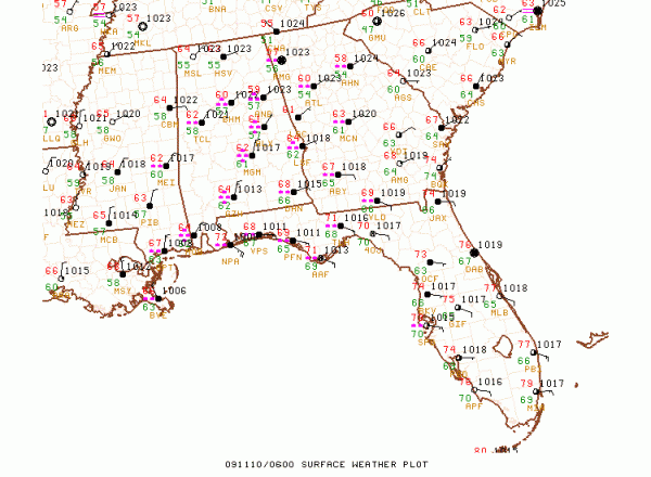
As one might expect, winds are strongest near the coast.
Some current coastal wind gusts:
Mobile: 39 mph
Pascagoula: 30 mph
Gulf Shores: 24 mph
NAS Pensacola: 40 mph
Destin: 35 mph
Petit Bois Island off Mississippi Coast: 47 mph
12 miles south of Orange Beach: 48 mph
Further Inland:
Evergreen: 28 mph
Greenville: 22 mph
Montgomery: 25 mph
In the Tuscaloosa, Birmingham and Anniston areas, winds will be sustained at 12-22 mph through this afternoon, with occasional higher gusts.



