


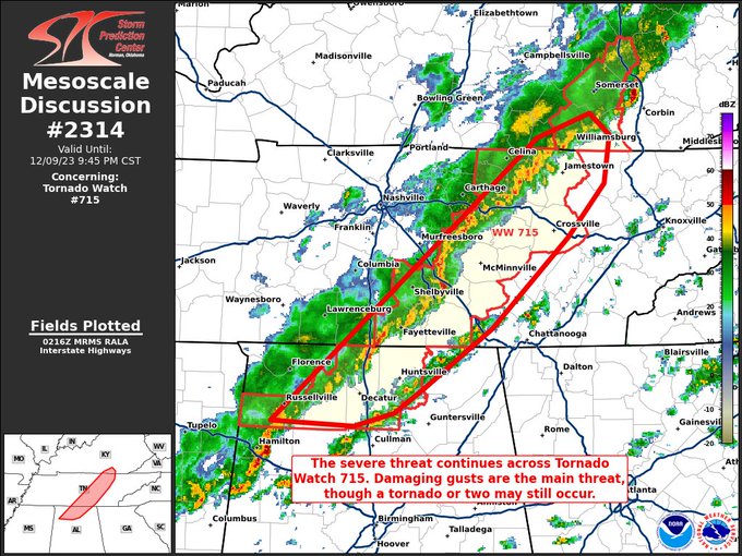
Here is the latest from the SPC:
The severe weather threat for Tornado Watch 715 continues.
SUMMARY — The severe threat continues across Tornado Watch 715. Damaging gusts appear to be the main threat, though a tornado or two cannot be ruled out over the next few hours.
DISCUSSION — Thunderstorms have consolidated into a QLCS across middle TN into northern AL. Buoyancy continues to gradually wane over the region, though impressive shear profiles remain (i.e. the latest HTX VAD, which shows an elongated, curved hodograph). Given the linear storm mode, damaging gusts should be the main threat as the QLCS progresses across middle TN and northern AL (the remainder of Tornado Watch 715). However, given the impressive shear profiles, any portion of the line where a sustained mesovortex can develop may support the development of a tornado.



