


Daily Weather Briefing
December 21, 2025
ALABAMA YESTERDAY
Saturday was cloudless and relatively warm, with highs ranging from the mid-60s in the north to the low 70s in the south.
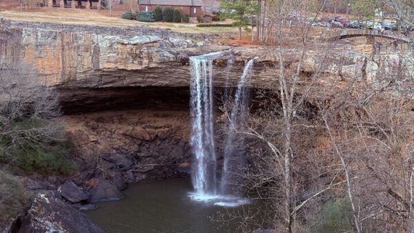
Skywatcher Brad McClaran sent in this photo from Noccalula Falls yesterday.
ALABAMA THIS MORNING
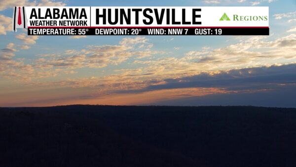
The first day of winter begins with a few light showers associated with a weak cold front near Albertville, Cullman, and Jasper, which is expected to move south throughout the day. Temperatures this morning are in the low to mid 40s in the east, increasing westward into the upper 40s and low 50s. Cloud cover is widespread.
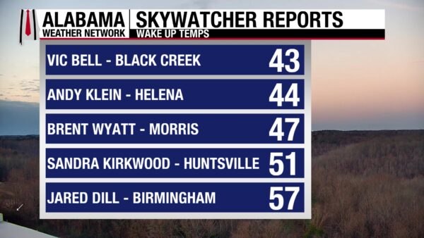
The Skywatchers wake to a chilly morning reporting temperatures in the mid to upper 20s and low 30s.
Join the team! Learn how to become a Spann Skywatcher: https://www.spannskywatchers.com/
ALABAMA 7 DAY FORECAST
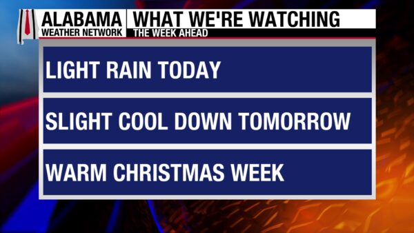
A mildly rainy and warm day is in store as the cold front moves through the state. Monday will cool off a little bit as light showers stick around through Tuesday evening. Temperatures from Wednesday through Friday will run well above average.
OVERCAST, SPRINKLY DAY
The cold front will move through the state today and should be mostly out of the area by around 7 PM. Light showers will follow the front, impacting north Alabama this morning, spreading into central Alabama by late morning and early afternoon, and reaching parts of south Alabama later in the day. Rainfall will be spotty and light, with early-morning totals in north Alabama remaining under a tenth of an inch. Winds may gust into the upper teens and low twenties today. Highs will reach the upper 50s in north Alabama, the low 60s in central Alabama, and the low 70s once again in the south. Not a very wintery day for the Winter Solstice!
CLOUDY NIGHT
Clouds will persist for most of the state tonight, but rain chances will diminsh for now. Lows will hit the low to mid 40s in northern Alabama and low 50s in the south.
SLIGHT COOL OFF MONDAY
Due to today’s cold front, partly cloudy skies, and the returning chance for showers, highs will be marginally cooler than today’s. North Alabama can expect mid to high 50s, central Alabama will reach the low 60s, and most of south Alabama will stay in the upper 60s.
TUESDAY BEGINS TO WARM UP
Although sprinkles and clouds are expected earlier Tuesday, highs will be able to climb into the mid 60s north and upper 60s and low 70s in central and south Alabama.
HIGHS CONTINUE TO RISE WEDNESDAY
Christmas Eve will be warm and sunny with highs reaching all the way into the upper 60s and low 70s in the north! The cross-state temperature gradient will not be steep, however, because highs in central and south Alabama will stay in the low to mid 70s.
WARM THURSDAY AND FRIDAY
Christmas Day and Friday will feel very similar, with highs in the north in the upper 60s and in the lower 70s in the south. The sun will continue to shine.
WARM UTAH
Multiple record high minimum temperatures were set near Salt Lake City, Utah yesterday, underscoring the continued warmth the west is experiencing. Records are listed as: location, new record, previous record (year set).
– Callao: 45, 31 (2010)
– Capital Reef NP: 35, 33 (2018)
– Cedar City: TIED 41, 41 (1981)
– City CK Water PL: 40, 34 (2023)
– Levan: 40, 36 (2023)
– Pine View Dam: 39, 32 (1943)
– Spanish Fork: 44, 41 (2023)
DOWNPOURS IN CALIFORNIA
Pacific moisture continues to batter California and the Pacific Northwest today and into the beginning of next week. The WPC has issued a Moderate Risk (3/4) of Excessive Rainfall today through Tuesday for a portion of northern California. Areas surrounding that are in a Slight (2/4) or Marginal (¼) Risk through Tuesday as well. Multiple flash flooding events are possible, as well as flooding streams and rivers. Debris is a concern within the flood waters in recently burned areas.
RAIN FOR THE CENTRAL GULF COAST
A cold front sweeps across the Southeast today and leaves southerly flowing moisture in its wake. This will cause rain in the region through Monday morning.
SNOW AND WINTRY PRECIP FOR PARTS OF MISSISSIPPI VALLEY AND NORTHEAST
Upper-level energy will cause light snow to fall over the Upper Mississippi Valley and Great Lakes on Monday morning. This energy will move eastward Monday into Tuesday, bringing the snow to the Northeast. Rain and freezing rain could fall along the rain/snow line in the Pennsylvania area.
RAIN FOR TENNESSEE/OHIO VALLEY AND MID ATLANTIC
Rain will move into the Tennessee and Ohio valleys Monday afternoon and sweep eastward to the Mid Atlantic by Tuesday.
NATIONAL HIGH AND LOW
Hidalgo, TX, hit a high of 92 degrees yesterday, and Opheim, MT, fell to a low of –8 degrees.
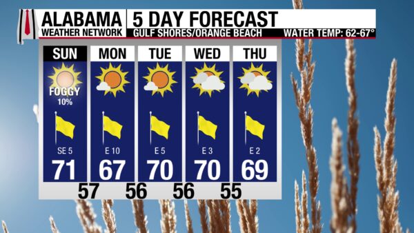
ANOTHER ENJOYABLE BEACH DAY
Calm waters and warm temperatures set the stage for another good beach day! The rip current risk is low, and the surf height is only around 1 foot. Winds will stay around 5 mph, and highs will be in the upper 60s with partly sunny skies. The only damper today is the low chance of showers in the afternoon/evening hours. Prepare for good beach weather all week.
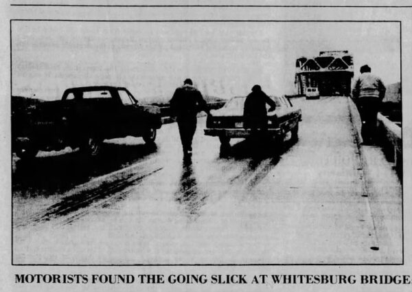
TODAY IN WEATHER HISTORY
December 21, 1981 – The Alabama Ice Storm
On December 21, 1981, a predawn burst of freezing rain and sleet coated much of North and Central Alabama in a dangerous layer of ice. Roads quickly turned slick, triggering more than 300 accidents in the Birmingham area alone as commuters attempted to navigate untreated highways. Two people were killed in southwest Morgan County, and another died near Winfield in Marion County. The icy conditions also caused at least 17 injuries from slipping and falling on sidewalks and driveways. In all, roughly 30 injuries were attributed to the brief but potent winter storm, which left the region encased in a hazardous glaze for much of the morning.
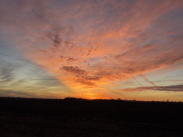
IMAGE OF THE DAY
Chris Pritchett tagged James Spann in an X post yesterday of the jaw-dropping sunset in Staunton, Illinois!



