


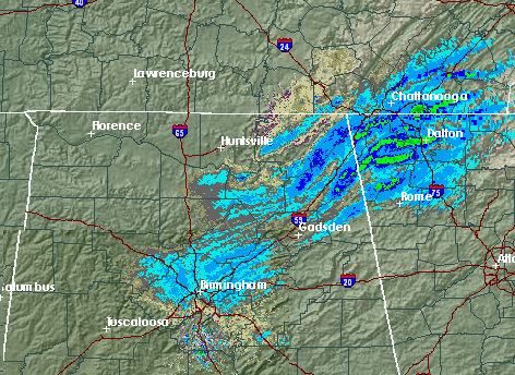
This radar composite from BMX and HTX shows the light snow moving through central and northeast Alabama this afternoon. Numerous reports of snow/sleet in north Alabama earlier, and now it is snowing lightly over much of Jefferson County (including in Trussville). This snow is associated with an upper-level disturbance moving through. Notice the effect of the mountains on the snowfall intensity in the mountains of NE Alabama.
Temps are generally above freezing in BHM, so don’t expect any major travel problems. Just be careful on higher roads like Shades Crest, Columbiana, etc. There could be a light dusting on higher ridge tops, especially NE of BHM (Blount, Cullman, St. Clair, Etowah, Cherokee, Dekalb, and Jackson counties), so drive carefully there this evening. Areas farther NE (Knoxville into the Carolinas) could get 1″+.



