


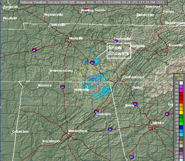
With the cold air pouring into Alabama tonight, some low-level moisture, and an upper-level disturbance to the north, a few snow flurries and showers have been reported over Tennessee tonight, and a few of these may make it into NE Alabama over the next few hours. Here is the Hytop, AL radar from around 1115 pm.
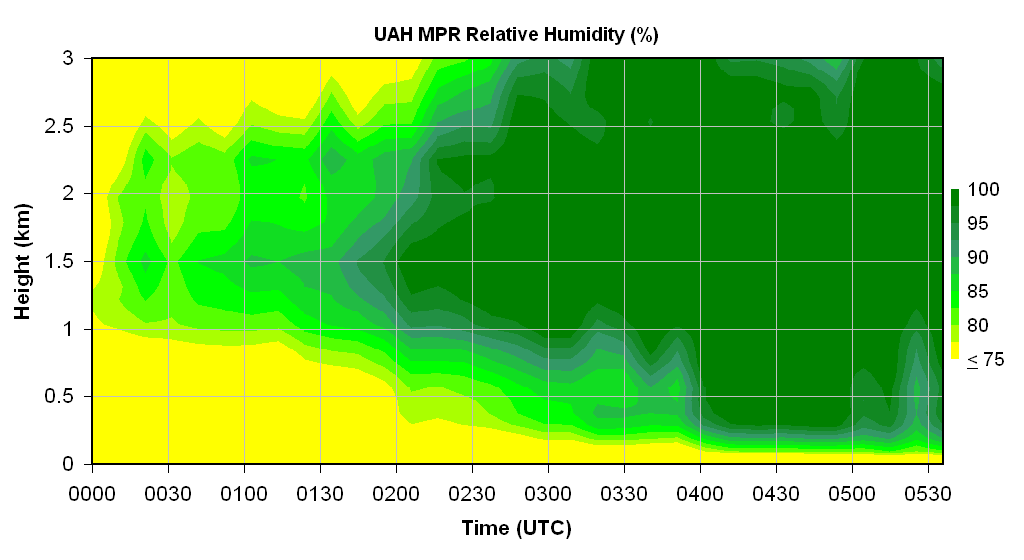
Below are temperature and relative humidity cross-sections from the UAH microwave profiling radiometer (times are in UTC). Notice that below freezing-temperatures are just above the surface in HSV (250 m, or about 750 ft.), plenty cold enough for snow. The relative humidity is also high at low-levels, so we might just have light snow in parts of NE AL, in Jackson, Madison, Marshall, Dekalb, and Cherokee counties. But, it shouldn’t amount to anything.
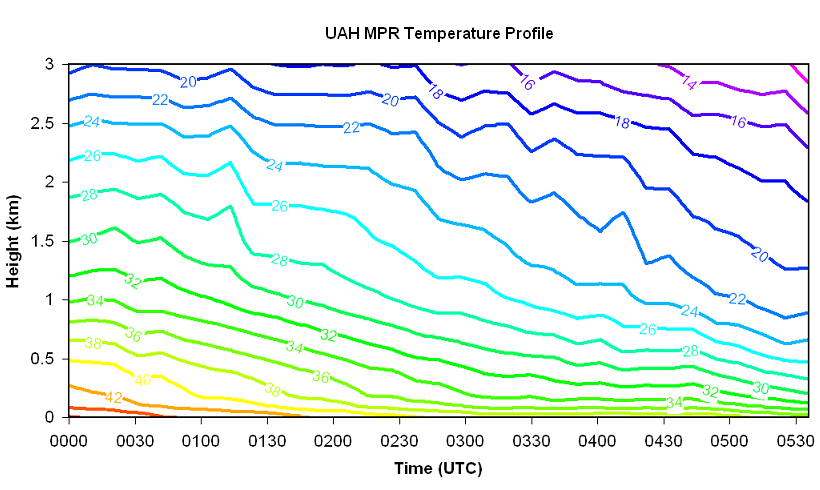
Also, with such cold temperatures at only 1 km (3,000 feet) in the lower 20s, it may have a hard time reaching 40 tomorrow, especially north of BHM where there could be a few clouds early.



