


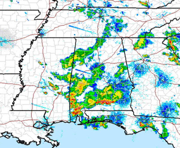
A busy day in the weather world has finally started to wind down. Many areas saw very heavy rain, even some isolated flash flooding was reported along with some gusty winds. The bulk of the storms have pushed well to our south and are causing headaches for folks along the Gulf Coast this evening. It looks to be a rough night along the Interstate 10 corridor from Mobile to Panama City.
Across Central Alabama, light to moderate rain continues to fall in many locations. Several areas with this activity are portions of Tuscaloosa, Lamar, Fayette, Sumter and Marengo counties. These showers will continue to dissipate over the next few hours as the push towards the southeast. Also, fog is likely to develop overnight and it could be dense in many areas. Use caution if you will be out and about overnight and encounter foggy areas.
Heading into tomorrow, it looks as though we could see a repeat of today. As northwest flow continues to dominate the weather in Alabama, we will have to watch for showers and storms that develop to our northwest. These storms will then begin to dive south across the state. Severe storms are possible, but most storms should remain just below severe limits. Storms will continue to produce tremendous amounts of lightning and very heavy rainfall that could produce flash flooding.



