


The National Weather Service maintains two different types of warnings across Alabama right now.
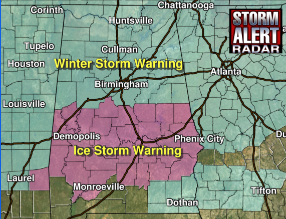
The winter storm warning is in effect for areas generally along and north of the I-20 corridor from Tuscaloosa to Birmingham to Anniston.
South of that, it is an Ice Storm Warning.
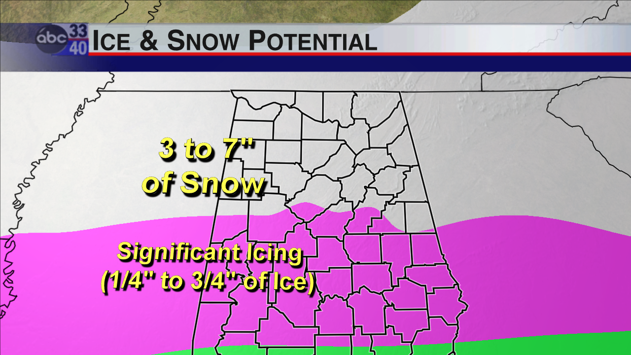
In the Winter Storm Warning area, the current freezing rain, sleet and snow may change over to snow tonight. There could be some very heavy snowfall rates, especially if any convective snow develops. You’ll know if it does, because you will hear thunder. Thus the snowfall accumulation forecast. But the snow will likely change back over to freezing rain and sleet, with a few transitions back and forth overnight. The result will be 3-7 inches of snow and 1/4 to 1/2 inch of ice on exposed objects. Travel is already extremely hazardous and will become nearly impossible overnight. Power outages will be likely.
In the Ice Storm Warning area, accumulations between 1/4 and 3/4 of an inch will cause serious tree and power line problems and result in significant power outages. Travel will become impossible.
Here is the current television graphic with accumulations:
Be ready for power outages. And please do not travel across Central Alabama.



