


Thunderstorms have developed radpily over southern Arkansas, northern Louisiana and Northeast Texas ahead of an approaching trough of low pressure.
Dewpoints in the upper 50s into the 60s have spread as far north as southern Arkansas tonight.
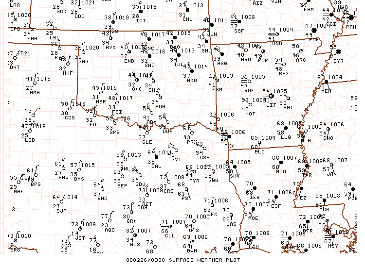
Temperatures aloft are much colder back with the trough. As that colder air aloft spreads eastward overnight, it will cause the atmosphere to become unstable and thunderstorms will continue overnight.
Wind fields are strong, with wind shear of 60-80 knots also spreading eastward over Arkansas, Louisiana and Mississippi.
A strong line of strosm has formed from Northeast Texas to just west of Shreveport to near Monticello in South Central Arkansas. Numerous severe thunderstorm warnings are in effect along this line. The storms just passed through one of my favorite towns…Plain Dealing, LA.
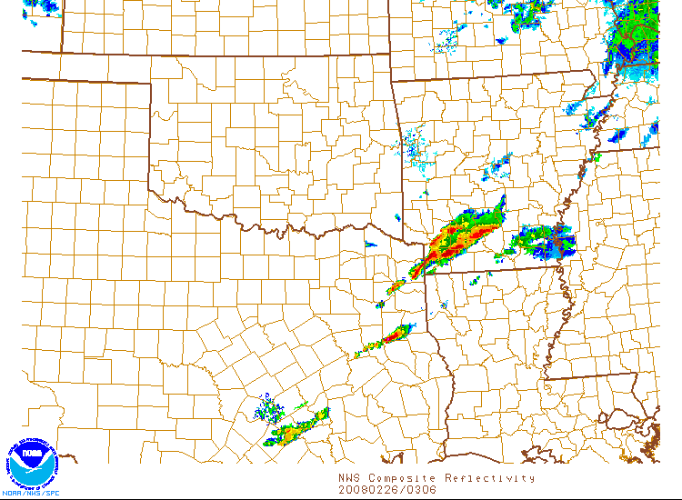
Large hail is a problem with these storms. Reports of marble to penny sized hail are being received from NE Texas. Radar indicates hail to the size of golfballs north of Eldorado and west of Monticello in Arkansas.
A late report was just received of quarter sized hail near Smackover in Union County, Arkansas.
With the strong wind fields, damaging winds will be a problem.
Any storms ahead of the main line may produce an isolated tornado. One crossing the Texas/Louisiana border heading toward Natchitoches, Louisiana is a candidate.
Activity could approach the Alabama/Mississippi border as early as 2 a.m.
The activity should reach the Birmingham area between 5 a.m. and 7 a.m.
Pay attention to overnight weather information. Severe thunderstorm watches and warnings are a near certainty overnight.



