


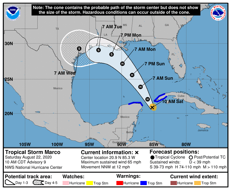
SUMMARY OF 1000 AM CDT…1500 UTC…INFORMATION
LOCATION…20.9N 85.3W
ABOUT 105 MI…170 KM ENE OF COZUMEL MEXICO
ABOUT 75 MI…120 KM SSW OF THE WESTERN TIP OF CUBA
MAXIMUM SUSTAINED WINDS…65 MPH…100 KM/H
PRESENT MOVEMENT…NNW OR 340 DEGREES AT 12 MPH…19 KM/H
MINIMUM CENTRAL PRESSURE…992 MB…29.30 INCHES
WATCHES AND WARNINGS
A Tropical Storm Warning is in effect for…
* Province of Pinar del Rio Cuba
* Cancun to Dzilam Mexico
DISCUSSION AND OUTLOOK
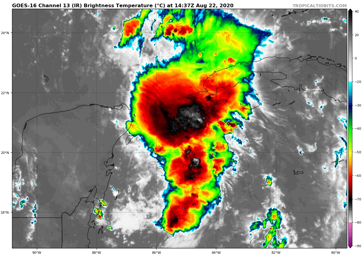
At 1000 AM CDT (1500 UTC), the center of Tropical Storm Marco was located by an Air Force Reserve Hurricane Hunter aircraft near latitude 20.9 North, longitude 85.3 West. Marco is moving toward the north-northwest near 12 mph (19 km/h), and this general motion is expected to continue through Sunday morning. A gradual turn toward the northwest and west-northwest is expected to begin Sunday afternoon and continue through Tuesday morning. On the forecast track, Marco’s center will move through the Yucatan Channel into the southeastern Gulf of Mexico by this evening. Marco will then move across the central Gulf of Mexico on Sunday and approach the central and northwestern Gulf coast on Monday and Tuesday.
Data from the Hurricane Hunter aircraft indicate that maximum sustained winds have increased to near 65 mph (100 km/h) with higher gusts. Additional strengthening is forecast during the next day or two, and Marco is expected to become a hurricane later today. Weakening is forecast to occur on Monday and Tuesday.
Tropical-storm-force winds extend outward up to 45 miles (75 km) from the center.
The estimated minimum central pressure is 992 MB (29.30 inches).
HAZARDS AFFECTING LAND
WIND: Tropical storm conditions are expected within the warning area in Cuba today. Tropical storm conditions are also still possible today within the warning area along the northeastern coast of the Yucatan Peninsula of Mexico.
RAINFALL: Marco is expected to produce 1 to 4 inches of rain, with isolated maximum amounts of 6 inches possible, across the eastern portions of the Mexican states of Quintana Roo and Yucatan, and across far western Cuba. This rainfall may result in areas of flash flooding.



