


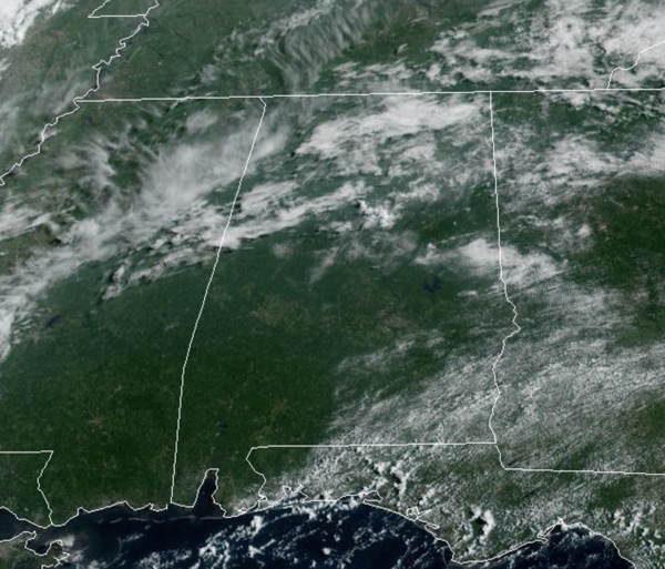
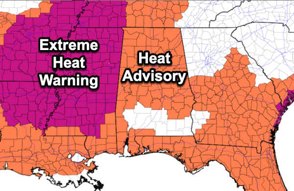
THE FINAL HOURS OF JULY: Alabama continues to deal with hot temperatures; highs in the low to mid 90s and high humidity. Heat index values are in the danger range which is why most of the state continue with under a heat advisory again. Good news, we should be done with widespread heat advisories after today for much of Alabama for a while.
Rain chances today remain around 50%, and any storms that develop this afternoon and evening with strong gusty winds in the form of downbursts. The lightning is the main threat with storms as very high instability is allowing for more frequent and more intense lightning, also, intense tropical downpours are likely.
BIRMINGHAM ALMANAC: For July 31st, the average high for Birmingham is 91° and the average low is 72°. The record high is 101° set in 1987, while the record low is 59° set in 1965. We average 0.16” of precipitation on this date and the record value is 4.31” set in 2012.
MUCH COOLER START TO AUGUST: Tomorrow will still be hot, highs in the low 90s and scattered showers and storms. But things begin to change for the weekend, as the ridge slides to the west. To the east, a high over the Ohio Valley and low off the Atlantic coast, will cause a wedge front to move in from the north and east over the weekend. This will send our temperatures tumbling for early August standards as highs will fall well into the low and mid 80s. In fact, some locations are likely going to see highs in the 70s for a few days, which could be record low highs. In addition to the cooler temperatures, rain chances will be higher and the days will feature more clouds than sunshine with occasional rain and storms. No wash-out, but expect rain and storms from time to time both days, with highest coverage during the afternoon and evening hours.
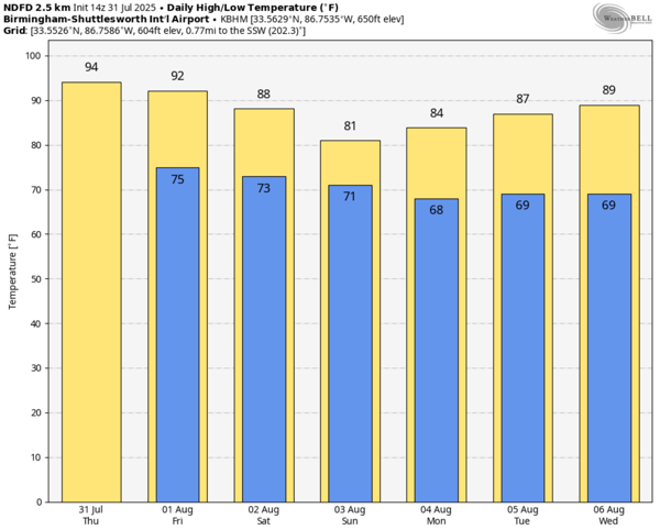
NEXT WEEK: Monday and Tuesday will continue to feature highs in the 80s, but through the week, the ridge to our west begins to strengthen and slide back east for the latter half of next week. Expect afternoon highs to return to the low and mid 90s. Each day will continue to feature random, scattered showers ands storms with the greatest coverage during the afternoon and evening hours…back to fairly routine early August weather for Alabama.

IN THE TROPICS: The entire Atlantic Basin remains quiet with no tropical cyclone development expected the next seven days. We continue to see a lot of Saharan Dust over the Basin which for now, is limiting tropical cyclone development across the Tropical Atlantic.
WORLD TEMPERATURE EXTREMES: Over the last 24 hours, the highest observation outside the U.S. was 123.8F at Omidieh, Iran. The lowest observation was -102.6F at Dome C, Antarctica.
CONTIGUOUS TEMPERATURE EXTREMES: Over the last 24 hours, the highest observation was 114F at Death Valley, CA. The lowest observation was 31F at Leadville, CO.



