


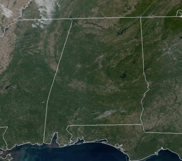
DRY START TO WEEK: After another chilly morning, we are seeing a big warm-up across Alabama this afternoon as upper 70s to low 80s are pretty common on the maps. It is another sun-filled day of weather. Tonight will be cool with widespread 40s expected, then tomorrow we reach the low 80s with a few more clouds in the sky.
RAIN FINALLY RETURNS: Clouds return Wednesday and will bring rain and storms with them by Wednesday afternoon into Wednesday night as a front approaches Alabama. A few stronger storms are possible and we note there is a low end “marginal risk” of severe thunderstorms Wednesday evening for the Tennessee Valley…A storms there could produce gusty winds and maybe some small hail, but this is not a major severe weather threat. Rainfall amounts should be in the 1/2 inch to an inch range and these are the best rain chances most of have seen in a while, but still not everyone will see rain this week.
BEHIND THE FRONT: Thursday through the upcoming weekend will feature more phenomenal fall weather. The rain ends very early Thursday and the sky becomes mostly sunny by the afternoon as dry air returns; the high will be in the mid 70s. Sunny weather continues Friday and Saturday with highs climbing from the low 70s Friday to the upper 70s Saturday. Another cold front will bring a chance of showers to the state late Sunday and Sunday night, but t looks like moisture will be limited and rain amounts will be light. The high Sunday will be in the mid 70s with a partly sunny sky.
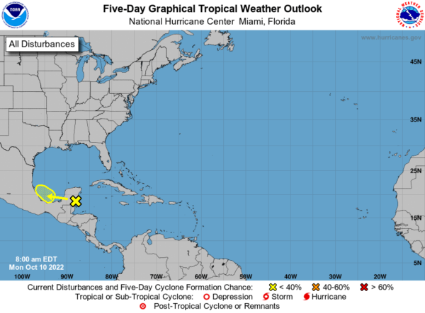
IN THE TROPICS: Julia will dissipate later today over Central America. An area of disturbed weather located to the north of Tropical Storm Julia is forecast to move westward toward the far southwest Gulf of Mexico during the next day or two. Some slight development of this system is possible by mid-week if the disturbance remains over water. Regardless of development, heavy rain is expected over portions of southern Mexico, Belize, and Guatemala during the next couple of days. Formation chance through 5 days…low…10 percent. Hurricane season officially ends November 30th so don’t let your guard down. Today is the four year anniversary of Category 5 Hurricane Michael making landfall at Panama City.
BEACH FORECAST CENTER: Get the latest weather and rip current forecasts for the beaches from Fort Morgan to Panama City on our Beach Forecast Center page. There, you can select the forecast of the region that you are interested in visiting.
WORLD TEMPERATURE EXTREMES: Over the last 24 hours, the highest observation outside the U.S. was 114.8F at Moti, Swaziland. The lowest observation was -78.9F at Concordia, Antarctica.
CONTIGUOUS TEMPERATURE EXTREMES: Over the last 24 hours, the highest observation was 104F at Death Valley, CA. The lowest observation was 15F at Peter Sinks, UT.



